Boulder Basin - The "Beretta" Bowl

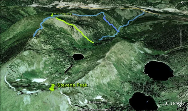
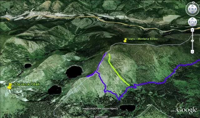
Upon the conclusion of last weeks D U M P!  The crew and I decided to head up to Willow Creek for what would undoubtedly be the best conditions of season at our favorite local spot.  NOAA called for something like 15-20 inches for the storm total....they were off...just a little...there ended up being  3-4 feet at 6000'!

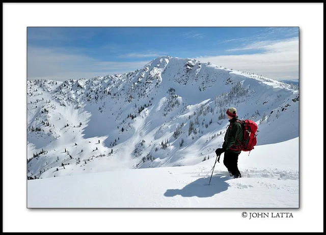
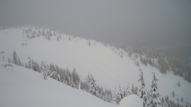
We started the day off with a warmup run in the Lucky Friday Bowl (named after an active mine which is seen down in the town of Mullan from the bowls top)  It was tempting to stay here all day as the conditions were DEEP.  The group was excited to check out a new area, although we knew the Lone Lake basin and Stevens peak were going to be off limits as stability was likely to be...well unstable.  We climbed over West Willow peak and continued along the ridge towards Stevens.  Wind was 20-25 out of the East, there was a solid wind slab being formed on all east facing aspects.  We stopped short of Stevens summit and ended up skiing west into

Beretta Bowl

and down to Boulder Basin.  What a great shot this is, takes some effort to get to when starting at Willow creek but well worth it.  After Beretta bowl we climbed up to a peak a bit further west and enjoyed another line back to boulder basin.  Skiing 3 feet of new, exploring boulder basin, being with some good peeps, cant think of  a better way to spend 9 hours on a Saturday.   

The "crew"

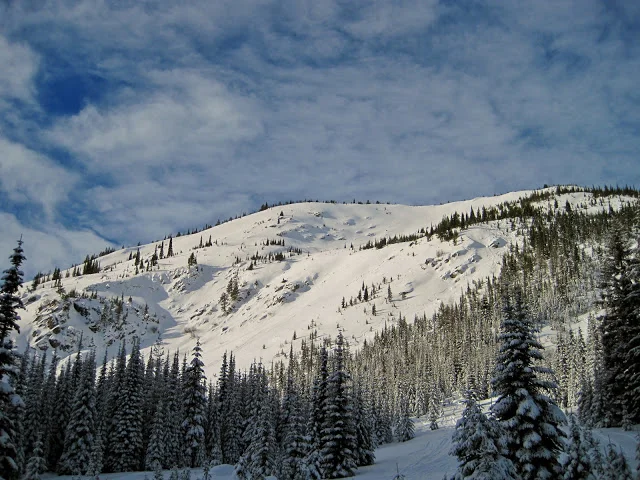
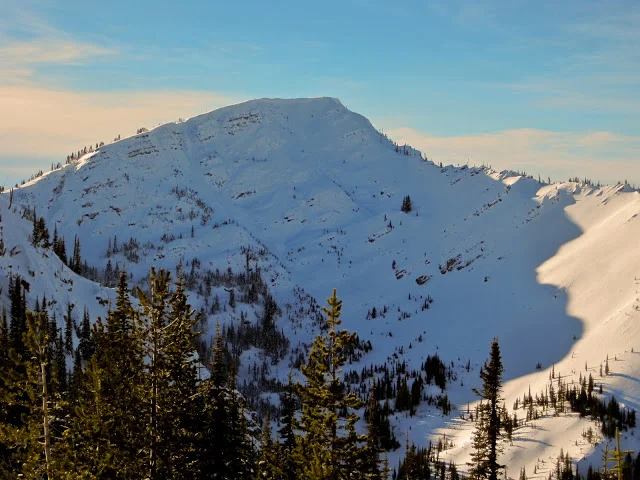
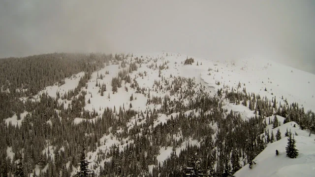
Stevens Peak up in the clouds

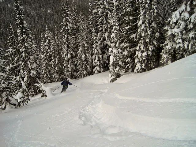
Bower entering Beretta Bowl

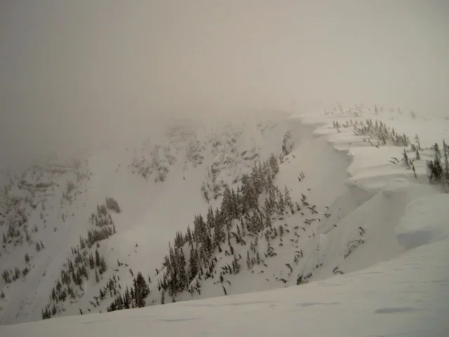
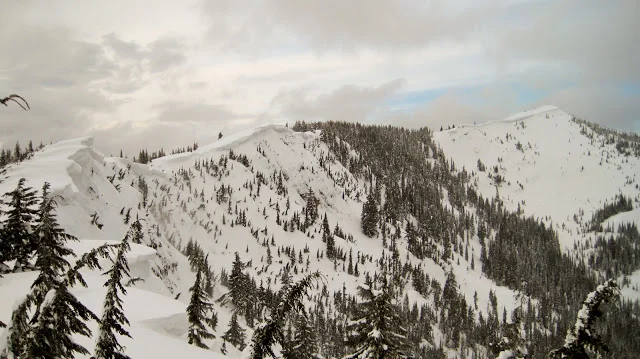
A look back at Beretta Bowl
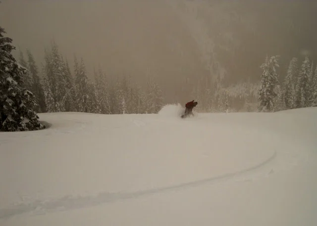
Scott

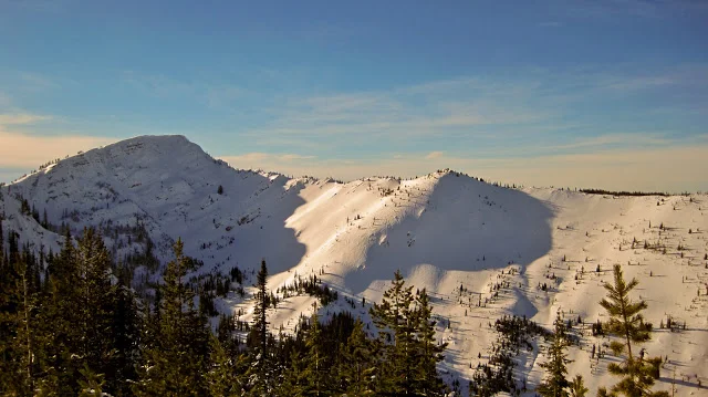
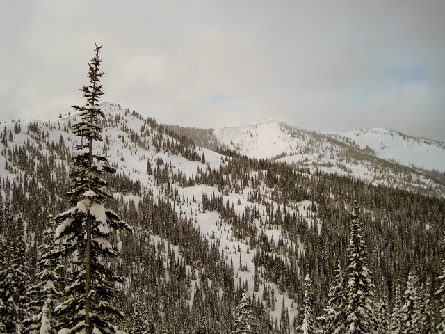
Peak on right looks like a future trip

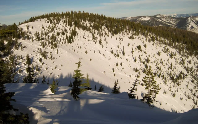
A look at our next line from the peak on the left

The Aftermath

Saturday  marked our return to the BC following the "January Thaw" cycle.  Bryan, Andrew, Derek and I left the willow creek TH at 0900, retracing my ascent from 1/9/11.   We continued slightly past the summit of West Willow Pk to dig a  pit at 6250' on an east facing slope.


What we found:
  • 30cm of heavy snow ontop of a 25cm thick ice layer (knife thick).  No one in the group had a snow saw so properly isolating columns within our snow pit was difficult. However while trying to isolate a column with cord and shovel handle the new snow layer and ice layer failed upon isolation (Q1) We noted similar reactivity with the bottom of the ice layer.  
  • Persistent weak layers below the ice layer appear to of "healed"  including the Dec 13th rain layer.     
With the decent viability we continued towards Stevens Pk summit to eyeball / recon future terrain.

Next we decided it was time to get some turns in among safer / more mellow terrain.  So we headed back to West Willow summit to ski its west side down towards the boulder basin drainage.

After climbing back out of boulder basin we returned to the north facing bowl called Wayne's World by the locals for a 1000' line followed by another 800-1000' line called the "Jammer" by locals.  All in all a good considering the conditions.  After a week of cooler temps and barring anymore warming events, next weeked should be a little more eventful. 


Bryan and Andrew on the climb up from willow creek


Steven's Peak


Andrew playing in Wayne's World

Chinook Winds + January Thaw - Hits the PNW

This evening, our driveway was void of snow for the first time since November.  The temps in Spokane for the past two days and for the next couple will be near 40 degrees.  Last week it didn't get above 17.

We have two phenomenons to thank:

1) The January Thaw:
  • January thaw, is a climatic phenomenon of unseasonably warm weather that tends to occur at about the same time every year, usually within about 10 days after the middle of January. Generally, the January thaw is gradual and temporary, lasting anywhere from a few hours to a week
  • The causes of the January thaw are known. General atmospheric circulation becomes more westerly, or even southwesterly, and mild Pacific air spreads eastward across Canada. The stronger-than-normal westerlies in mid latitudes tend to confine Arctic air northward and favour the intrusion of warm, humid air from the subtropics into the eastern US and Canada. Although the westerly flow may last several days, it inevitably shifts to northwesterly, again allowing cold outbreaks of Arctic air to stream southward and eastward.
  • Still a mystery, though, is why this phenomenon occurs when it does. Some researchers offer statistical evidence for a relationship between January thaws and sunspot activity.
2) Chinook Winds
  • The reference to a wind or weather system, simply "a Chinook", originally meaning a warming wind from the ocean into the interior regions of the Pacific Northwest.  A strong Chinook can make snow one foot deep almost vanish in one day. The snow partly melts and partly evaporates in the dry wind. Chinook winds have been observed to raise winter temperature, often from below −20°C to as high as 10°C to 20°C.  

There are too many red flags out there right now!  What does this mean for us?  A study/relax weekend :(


Red Flags:
  • 75 mph winds reported in the southern Selkirk's of northern Idaho today = massive wind slabs being formed on a layer a couple of feet thick of upside down snow deposited on surface hoar and facets formed earlier this week, not to mention persistent weak layers deeper in the snow pack.
  • heavy wet snow falling on top of a dry cold snow pack = a non-supportive very reactive interface between the two layers
  • my pit results from 6000' on 1/9/2011 revealed and confirmed two different faceted weak layers,  these weak layers were not very reactive but present.  With the load from the heavy snow on top, these weak layers will surly play a roll and possible encourage a slide to step down into the Dec 13 rain crust that still persists.   
Location:Palmer creek
Date: Jan 12th, 2011
Photographer:Kevin Wright
Description: 01/07/2010 avalanche event. Skier triggered, full burial. No
injuries. Investigation showed the initial weak layer as buried
surface hoar with weak facets, stepping down to facets above and
below the November 22 rain crust. Deeper parts of the crown face
were on top of the rain crust


The GOOD news...The powder will come back.  This cycle should be good for stability in the long term....if not back to CANADA:) 

The Elusive Stevens Peak

Today, K had to work so rather then another solo job I met up with a local skier (a shovel partner just in case) and traveled to Willow Creek of the Bitterroot Range. 

On Christmas Day I skinned up St Regis Basin

and was rewarded with amazing

views of Stevens Peak

, which happens to be the highest peak in the immediate area, and probably the most interesting terrain within an hour and a half of Spokane.  My goal today was find an easier way to the summit and do some recon on some lines.  Unfortunately it snowed all day and the sun never broke through.  We were within a half mile of the summit along the summit ridge and still no cheese.  However the approach beat the 6.5 miles up St. Regis Basin.

After our turnaround point spotted what appeared to be our best line down to the bottom of West Willow Basin, taking us back to the summit of west willow peak to ski its east shoulder.  During the skin back to its summit we came across another group of skiers, including John Latta, a professional photographer who frequents the area.  He suggested

his website

as a means to contact him, if looking for a skiing buddy in the future, friendly guy.  Anyway I'm borrowing one of his pics of Stevens Peak, which appears to be taken from just beyond our turnaround point.

John's photo of Stevens Peak

and all its attractive chutes, just begging to be skied by K and I in the near future.

John Latta's photo of the north face chutes of Steven's Peak

Today's tracks

The "JAMMER" as called by my ski partner today, been there since logging stopped in the 80's.  Appears to be a sticker magnet for passing skiers

Its boom is made out of a tree

The top portion of our run off of West Willow Peak

Christmas Day - St Regis Basin

A solo jaunt (10 miles roundtrip) up St. Regis Basin, MT.  A recon mission of sorts, turns into a fan-tabulous bluebird day in the BC.

Skin track in blue

A subtle reminder of the dangers one may encounter in the BC

 I would later find myself on top of the ridge seen at the top of the photo

 Stevens Peak and its surrounding terrain, which we will be skiing this season for sure!

 Which line first?

Here I am standing on the border of ID and MT, eying my line back down to St. Regis Basin