Climbing @ the Coulee - Vantage, WA

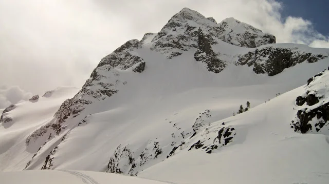
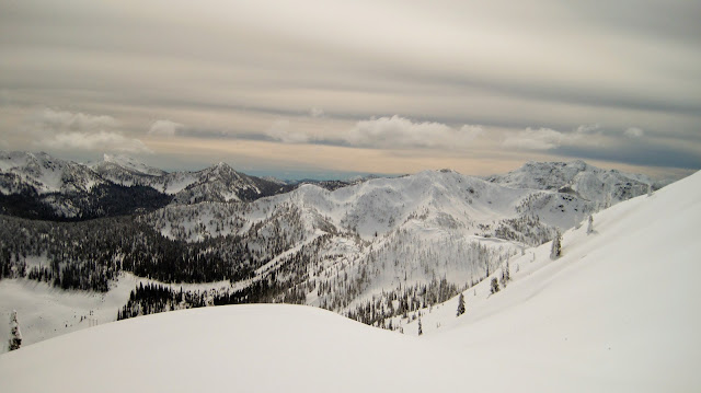
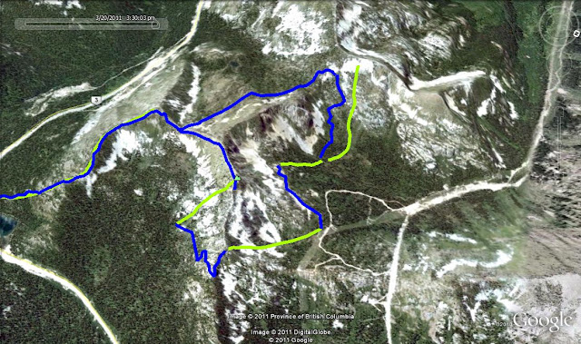
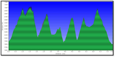
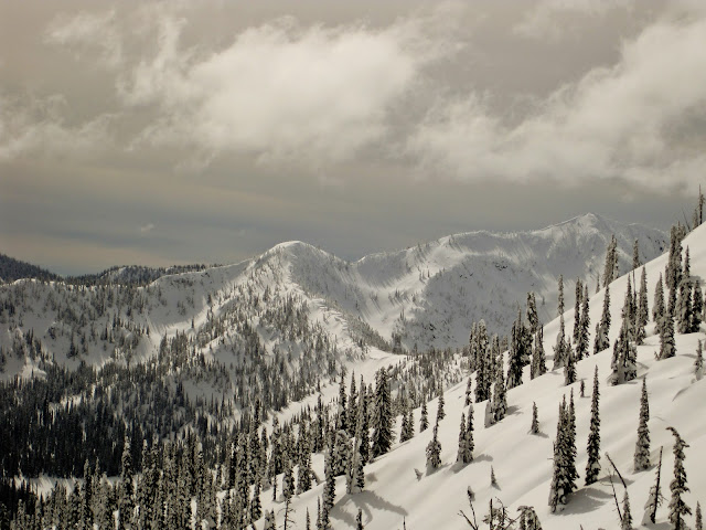
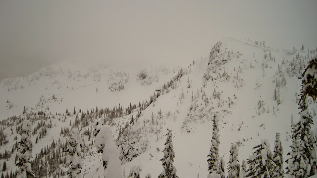
First multi-day climbing trip of 2011.  Casey, Brian and I headed down to Vantage for 2 days of climbing.  Saturday we climbed at the Millennium, Hen House and Feathers walls.  Sunday we braved the crowds at the popular Sunshine wall, show how scoring two of its classics, Ride' Em Cowboy and Boschido. Followed by two 4 star routes down on the Fat and Skinny Man walls,  the climbing here tends is steeper and more powerful due to the fractured basalt.  Very Deep Creek like:)

Ride' Em Cowboy (5th pillar over from left).  Classic arete, area classic

Ride'Em Cowgirl - Casey

Me on Boschido

Boschido's Crux

Noteworthy Sends:

Thunder Run 5.10b
OS

Monsters Under My Bed 5.10b
RP

Harvest 5.10c
OS

Boschido 5.10c
OS

Fresh Eggs 5.10d
OS

OH CANADA - Garibaldi Provincial Park

Day 2:

OH CANADA... OH CANADA... whyfore art thou in my backyard?  Every backcoutry skiing enthusiast  needs to experience the Garibaldi's, this way Im not the only one seeking counseling for Canadian backcountry withdrawal! :) The opportunities are endless, next season larger packs and tents are to be brought along!

Peaks Skied:

1) Spearhead

2) Decker

3) Blackcomb Glacier 

Overview of our day via GPS tracks

Decker after Riding Spearhead's SE face. For perspective note the skiers putting in the skin track for us:)

Our line off Spearhead

K here as we make our way up Decker Glacier.  Spearhead and Run 1 in the background

View from Decker : Left to Right = Trorey, Overlord, Whirlwind, Fissle

Fissle and our future line:)

Another perspective shot, note the skier traversing under Trorey, heading towards Pattison

Our line off Decker

Kristin's entrance off of Decker.  I pee'd and tightened my boots before her run was over. LEG BURNER

Our last run of the day, down Blackcomb Glacier.  This thing was TOO long!  There is an additional 3 miles of to be skied, crossing through Blackcomb resort, finally dumping out at the famous Whistler village

Yet Another Bites the Dust - Joffre Group

Day 1:

Kristin, Drew and I rendezvoused in Seattle for what we hoped would be an epic trip up to Whistler,  British Columbia.  Sunday morning we popped into a Whistler village gear shop and equipped Drew with a splitty.  Hence the title "Yet Another Bites the Dust"  :)  I believe this is victim # 3...As Drew was jones-in to purchase a splitboard after his first split tour of: Joffre Group, Pemberton Area, British Columbia.  I'm not sure if I like spreading the love for the sport or if I just like increasing my odds of finding partners to dig us out on any given weekend:)  The Joffre group is accessed via the Sea-to-Sky Highway, about 1 hour beyond Whistler or 20 minutes beyond Pemberton.  The iconic

Anniversary Glacier sits between Joffre and Matier Peaks

, and provides a rather safe ascent route to either Joffre's W couloirs or Matier's N face.  At the base of the glacier also sits a hut

(Keith's Hut)

that is rumored to sleep 15+ people.  So next year... hut trip for sure!

After a 2-3 hour approach, the skies started to clear, giving us a view of Anniversary glacier and encouraged a change of plans, which involved skiing Anniversary glacier as opposed to Vantage Pk.  So we started the the climb up Joffre's East ridge to gain access to the Anniversary glacier.  It was here during a lunch break that Drew poised the question..."Do you hear that"...and I answered "ya its a plane".  ERRR wrong it was a rather HUGE av, originating from Joffre's NE steep rocky face.  We scrambled for our cameras and tried to catch it on video

(see video below)

. I was only able to catch the final runout. the whole basin then filled with a snow cloud.  The "jet roar" was preceded by a large bang.  Which leads me to think rockfall caused by the intense warming was the trigger for the slide, as there was no signs of stability in the snowpack itself.  The Anniversary Glacier's skiers right provides a long powder filled shot right down to its base, resulting in a ~ 3000' foot run.

Anniversary Glacier, Joffre Peak on the right

Vantage Pk

Matier Pk and the line down Anniversary Glacier

Joffre Peak

The man of the day DREW DAWG - Put on his big boy pants and rode the split - soon to be addicted

K DAWG showing how the treacherous icy bridge crossing is done:)

Which Addiction? - Frechman Coulee, WA

We've all had some difficult decisions in our lives; K and I were faced with one of them this past weekend...Head north to British Columbia to rock the splitties or head south to crush some rock.  I cant tell you how many times we went back and forth, we had one room staged with skiing gear and another with  climbing gear.  Being in the sun as opposed to playing in the cold snow, won the dilemma battle... this time.

Thus we headed down to Frenchman Coulee aka Vantage.  This unique area overlooks the Columbia River Gorge, an area carved by glacier migration many many years ago.  The majority of the crags face south, thus converting Vantage into a popular winter destination...especially for all those Seattle-ites, who flee Seattle in hopes of finding something other then rain.

The setting and climbing at Vantage reminds me of one of my favorite New Mexico crags Diablo Canyon .
Vantage offers around 700+ routes both sport and traditionally protected crack climbs between vertical pillars/columns.  Below is a pic of one of the sectors at Vantage, which is then broken up into 8-10 differently named crags.      

The highest concentration of Vantage routes are seen here, including Sunshine Wall, RiverView Park, Millenium, Fat Man, Skinny Man, M&M walls.  Climbing exists on both the upper and lower cliff bands.
Kristin on Aeolachrymation 5.8 at the Riverview Columns

This ones for you Grandma Aloys (GG)
What an awesome first weekend back on the rock...first day climbing since last December:)  Defiantly took it easy, finding out I'm only a 5.10 climber off the couch.  Kristin on the other hand looked like she picked up right where she left off...she seems to improve on every route, she is gonna be strong with some training:)

Noteworthy Sends:
A Genius Bruing 5.10a
OS
Mortal Prying in the V Shaped Realm  5.10b
OS
Hakuna Matata 5.10b
OS

"The Ghost Rider" - Wolf Peak Zone

Finally a bluebird day at ol Kootenay Pass!  Its amazing what a little vis can do,  even after yesterdays long tour, the group was ready to get after it.  Maybe it was the sun maybe it was electric energy buzzing overhead in the powerlines.  Finally figured it out...the reason the locals call it Buzz's ridge.  The goal was to explore the massive bowl at the end of Buzz's ridge, after our tour yesterday we figured it would be more efficient to access the bowl from the Creston side of the pass, rather then dealing with the mile plus of ridge travel across Cornice Ridge Peak. So we made our way up Pristine Pass to just under Wolf peak.  From here we traversed under wolf to try and gain the east lip of the massive bowl.  Well that turned out to be less than an easy task.  After finding a steep but safe route to the bowls east lip, we ended up not able to access the bowl due to what were questionable lines, it was hard to tell if any of the shots underneath our noses would go.  Thus we skied the east face from the lip back down towards wolf peak.  Still amazing conditions. After this drop we decided to stop for a bit of a food break.  This was when the ghost rider broke out of hiding.  My unattended board decided to cruz down the mountain without me, first at a crawl, then gathering speed it took a rather aesthetic line down the bowl underneath wolf peak.  Derrick and Julie jammed after the runaway while i started postholing to my crotch!  After about a 400 foot run, the ghost rider got caught up in two trees at the edge of what would of been a steep shot with no barriers for another 400 or so feet...and surely the end of our day.  However it ended up being a slight detour...:)  oops!  After climbing back out of the bowl, we worked our way south around the edge of the bowl, trying to find another way to access the massive bowl.  Unfortunately visibility started to get worse and time was slipping away.  Thus we decided for the long shot back down to the power lines, starting from the termination of buzz's and the beginning of the massive bowl.  What a line it was, the conditions were great....ooh I can only dream what the north aspect of the massive bowl would of been like.  NEXT TIME    

Just short of 8 miles, with a huge tease... the large bowl was well guarded by steeps and cornices

our elevation profile

Wolf Peak and a few of our lines skied (blue dots)

Julie and Derrick scouting the area from our high point. 

Looking east to Wolf Peak

The massive north bowl, which sits at the termination of Buzz's ridge.  

This bowl is FOR SURE the focus of our next trip to Kootenay Pass:)

Derrick waiting below, Julie getting 2nds

The zone we skied the day prior...Cornice Ridge Peak

A look back up our final run

"Appropriately" Named - Cornice Ridge Peak

Derrick, Julie and I (friends from Spokane) decided on a ass-crack of dawn departure from Spokane Saturday morning allowing for two full days of touring among the Kootenay's of Canada.

The weekends plan was to ski the zones north of Kootenay Pass.  Saturday unfortunately ended up being one of those all to common low visibility days.  Between the visibility and the miles of heavily corniced ridge, finding safe lines to ski was a challenge. At one point in the day I cautiously crept towards a cornice that ended up snapping off in a blink of an eye.  The result of the cornice break was me flying through the air in the opposite direction, kinda like a cat.... well a cat with a stoned like reaction.  Lets just say, your not going to jump off a cornice before it breaks:) Later on in the day on the west face of Cornice Ridge Peak we noticed a

huge fraction line

that appeared to originate from a large rock outcropping, then managed to propagate for about 100 yards, likely the result of a warm clear Friday.

Quick plug for an amazing meal after skiing at the pass.  This little gem of a restaurant sits amongst a handful of liquor stores and a gas station based SUBWAY in the quiet mountain town of Salmo.  Derrick said it the best "Why cant the US give a shit about their food like these Canadians".   Check it out: 

The Peppercorn Bistro

8 mile day tour ( yellow is lines skied)

elevation profile

A view of Cornice Ridge Pk taken from near Wolf Pk (Sundays Tour).  We skied the lookers right face of the  lower rounded sub peak 

An inviting chute.  Notice the large fracture line on the face in the background

The best visibility we had all day, unfortunately we are back in the truck and heading to Salmo

Shut Down - Left with Pineapple Pass

With our shortened weekend (working on weekends should be forbidden), we decided to check out Snoqualmie Pass.  It wasn't more then 10 minutes into the approach climb to source lake basin under

Chair Peak

, that plan B was put into motion.  Mother nature decided to be on our side and started throwing up red flags left and right.  Visibility sucked as yet another front had arrived a tad earlier then expected, thankfully with the low vis we were still able to note natural slide activity on most aspects, and at lower elevation.

Note the crown

 We crossed countless av debris piles from the previous days warming.  Most of the slides appeared to originate from near rock outcroppings, which makes sense giving Fridays clear skies and warm temps.  Most of the slides involved what appeared to be 12" plus crowns, probably near a hoar frost layer that presumably formed sometime last weekend during some very cold clear nights.  Then almost every day last week came a series of fronts crossing the Northwest causing periods of strong winds and snowfall. Temperatures had generally been warming preceding the fronts and cooling following the fronts.

Not visible on the pic, but top center in the clearing with larger trees on either side is another large crown.  This area was going to be crossed as part of plan A

 Plan B:

Included a tour upto

Pineapple Pass and the Tooth

.  Followed by a long shot down to Denny Creek.  After a climb back to Pineapple Pass, we tried to enjoy the near perfect from the pass, however visibility was well....ZERO, resulting in what felt like DRUNKEN snowboarding.  It was borderline comical, we ate $H!T countless times thanks to the vertigo and the inability to see ANYTHING.     

Pineapple pass with the tooth visible as the sharp formation lookers right of the pass

blue are actual GPS tracks

The tooth and Pineapple pass

The tooth as seen from top of Pineapple Pass

K enjoying the improved visibility provided among the trees

"Thigh Highs" - Kootenay Pass Style

POWDER DAY!  What an amazing day 2/27/2011 was.....the lightest deepest conditions of the season hands down!  After a huge dump throughout the night we arrived arrived at Kootenay pass ready for an epic day.  Plans were to run a lap on the frontside of Baldy Pk before returning to its summit for a descent down towards Crags Pk. basin.  Our third run of the day was from near the summit of Crags Pk.  The pics will tell the rest. 

GPS tracks in blue, approx runs in yellow (Crags Pk left, Baldy Pk right)

A little giddy

Choker- Andrew

Blower - Chuck

Needed a snorkel- Andrew - he was actually doing a "freestyle" stroke through the POW..it was that lite

Faceshots - Kristin

Whiteout - Chuck

My friends - needed the trucks heat, pulling off before they are ready...hurts

Boulder Basin - The "Beretta" Bowl

Upon the conclusion of last weeks D U M P!  The crew and I decided to head up to Willow Creek for what would undoubtedly be the best conditions of season at our favorite local spot.  NOAA called for something like 15-20 inches for the storm total....they were off...just a little...there ended up being  3-4 feet at 6000'!

We started the day off with a warmup run in the Lucky Friday Bowl (named after an active mine which is seen down in the town of Mullan from the bowls top)  It was tempting to stay here all day as the conditions were DEEP.  The group was excited to check out a new area, although we knew the Lone Lake basin and Stevens peak were going to be off limits as stability was likely to be...well unstable.  We climbed over West Willow peak and continued along the ridge towards Stevens.  Wind was 20-25 out of the East, there was a solid wind slab being formed on all east facing aspects.  We stopped short of Stevens summit and ended up skiing west into

Beretta Bowl

and down to Boulder Basin.  What a great shot this is, takes some effort to get to when starting at Willow creek but well worth it.  After Beretta bowl we climbed up to a peak a bit further west and enjoyed another line back to boulder basin.  Skiing 3 feet of new, exploring boulder basin, being with some good peeps, cant think of  a better way to spend 9 hours on a Saturday.   

The "crew"

Stevens Peak up in the clouds

Bower entering Beretta Bowl

A look back at Beretta Bowl

Scott

Peak on right looks like a future trip

A look at our next line from the peak on the left

From Sea to Shining......Rain Crust !

Oddly enough this past Saturday was our first time skiing in the state of Washington other than a few November laps up at Mt. Spokane.  Friday night we drove through a warm and soggy

Snoqualmie Pass

, on our way to visit a friend in

Blaine, WA

or is it Blaine, Canada...?  Our visit rocked...it literally rocked as we spent the night on a sailboat (MARARA) in Dayton harbor about a rocks throw away from the US/Canadian border.  

Water Skies or Snow Skies?

The next morning we drove east on HW 542 to its dead-end point beneath the massive glaciated

Mt. Shuksan

. This was our first time in the area, and knowing that the conditions were going to be less then awesome... thanks to the

January thaw

!  Thus we planned on climbing to the saddle between Mazama Dome and  Table Top Mtn, which

can

(the key word as it was lightly snowing) provide a view of two north cascade "icons"

Mt Baker

and Mt. Shuksan.  

Our skin track in yellow.  After a brief but timely revealing of the "icons" we rode a similar line back down to the car through a nasty breakable crust :( 

Mt. Shuksan

Mt Baker

Enjoying Seattle after the less then awesome conditions on Saturdays tour

The "Pinch and Roll" Method

Tired of trying to separate what seem to be inseparable skins during transitions in the backcountry. Especially when yo-yoing your favorite low angled glade during those high avalanche danger days. Being a split-boarder I'm always looking for ways to improve my transition times. Since valuable time is consumed when trying to peel apart the damn skins (especially with the 2010 glue formulation, the ones w/o the tape down the center), why not try to eliminate this step? Thus the "pinch and roll".

SKINS OFF:
Simply hold the tail of climbing skin, glue side facing you. Start rolling it up. No worries the glue does not stick to the mohair and more importantly the glue can't stick to the glue. Result: a small easy to pack and easy to separate climbing skin.


Note: The skin clip / bar....whatever you want to call it.   Its now ready to hang from the tip of the ski for the SKIN ON (see next pic)

SKINS ON:
Place the skin clip on the nose of your ski and start  unrolling.  A big plus to the "pinch and roll"  is noticed here, by lessening the chance of getting snow on the glue.  As you unroll the skin it interfaces with your ski immediately, super nice in windy conditions too. 


NOTE:
Only use the pinch and roll while touring. Remember it is important to store your skins the traditional glue to glue fold method, to prevent the glue from drying out, it also helps to redistribute and restore the glue.  Additionally if you notice your skin glue loosing its stickiness while touring, simply store it glue glue ( the fold method) on your next transition.

CONSIDERATIONS:   On those warm spring days days there may be a chance of the mohair sticking to the glue its self.  Thus consider the traditional fold method, as it is usually easier to pull the skins apart on warm days anyway.  An additional concern during warm spring conditions is the use of skin wax.  There is also a chance of the wax on the mohair sticking to the glue.

The Aftermath

Saturday  marked our return to the BC following the "January Thaw" cycle.  Bryan, Andrew, Derek and I left the willow creek TH at 0900, retracing my ascent from 1/9/11.   We continued slightly past the summit of West Willow Pk to dig a  pit at 6250' on an east facing slope.


What we found:
  • 30cm of heavy snow ontop of a 25cm thick ice layer (knife thick).  No one in the group had a snow saw so properly isolating columns within our snow pit was difficult. However while trying to isolate a column with cord and shovel handle the new snow layer and ice layer failed upon isolation (Q1) We noted similar reactivity with the bottom of the ice layer.  
  • Persistent weak layers below the ice layer appear to of "healed"  including the Dec 13th rain layer.     
With the decent viability we continued towards Stevens Pk summit to eyeball / recon future terrain.

Next we decided it was time to get some turns in among safer / more mellow terrain.  So we headed back to West Willow summit to ski its west side down towards the boulder basin drainage.

After climbing back out of boulder basin we returned to the north facing bowl called Wayne's World by the locals for a 1000' line followed by another 800-1000' line called the "Jammer" by locals.  All in all a good considering the conditions.  After a week of cooler temps and barring anymore warming events, next weeked should be a little more eventful. 


Bryan and Andrew on the climb up from willow creek


Steven's Peak


Andrew playing in Wayne's World

Staying Alive In Avalanche Terrain

Staying Alive in Avalanche Terrain, Bruce Tremper, Mountaineer’s Books, 2008.  
Bruce has been the director of the Utah Avalanche Center center since 1986.


A must have / read in any backcountry skiers or snowboarders safety quiver. This avalanche safety how-to is perhaps the best available for backcountry skiers and snowboarders. It looks at the issue from a practical view, assuming you WILL go out in avalanche terrain.   Bruce shares the knowledge gained from his 25yrs of professional avalanche experience. Full of firsthand wisdom, terrific illustrations & photographs this is a very readable text on what often is a very dry subject. If you travel in avalanche terrain you want to read this book, and re-read it every fall:)   

Most avalanche classes are taught by nationally recognized members of the American Avalanche Association (AAA), AIARE, the Canadian Avalanche Association, and a host of mountain rescue specialists which adhere to the AAA's Guidelines for Avalanche Course Curriculum.  The curriculum and Bruce Tremper's book are almost one in the same.  As a matter of a fact many level 1 av classes require reading the book prior to class, some will actually include the book once registered for the class (Silverton Avalanche School)
  
Deeper's Forrest Shearer & author Bruce Tremper were interviewed on NPR this past week about avalanche danger. Listen here: http://bit.ly/e604ts


Chinook Winds + January Thaw - Hits the PNW

This evening, our driveway was void of snow for the first time since November.  The temps in Spokane for the past two days and for the next couple will be near 40 degrees.  Last week it didn't get above 17.

We have two phenomenons to thank:

1) The January Thaw:
  • January thaw, is a climatic phenomenon of unseasonably warm weather that tends to occur at about the same time every year, usually within about 10 days after the middle of January. Generally, the January thaw is gradual and temporary, lasting anywhere from a few hours to a week
  • The causes of the January thaw are known. General atmospheric circulation becomes more westerly, or even southwesterly, and mild Pacific air spreads eastward across Canada. The stronger-than-normal westerlies in mid latitudes tend to confine Arctic air northward and favour the intrusion of warm, humid air from the subtropics into the eastern US and Canada. Although the westerly flow may last several days, it inevitably shifts to northwesterly, again allowing cold outbreaks of Arctic air to stream southward and eastward.
  • Still a mystery, though, is why this phenomenon occurs when it does. Some researchers offer statistical evidence for a relationship between January thaws and sunspot activity.
2) Chinook Winds
  • The reference to a wind or weather system, simply "a Chinook", originally meaning a warming wind from the ocean into the interior regions of the Pacific Northwest.  A strong Chinook can make snow one foot deep almost vanish in one day. The snow partly melts and partly evaporates in the dry wind. Chinook winds have been observed to raise winter temperature, often from below −20°C to as high as 10°C to 20°C.  

There are too many red flags out there right now!  What does this mean for us?  A study/relax weekend :(


Red Flags:
  • 75 mph winds reported in the southern Selkirk's of northern Idaho today = massive wind slabs being formed on a layer a couple of feet thick of upside down snow deposited on surface hoar and facets formed earlier this week, not to mention persistent weak layers deeper in the snow pack.
  • heavy wet snow falling on top of a dry cold snow pack = a non-supportive very reactive interface between the two layers
  • my pit results from 6000' on 1/9/2011 revealed and confirmed two different faceted weak layers,  these weak layers were not very reactive but present.  With the load from the heavy snow on top, these weak layers will surly play a roll and possible encourage a slide to step down into the Dec 13 rain crust that still persists.   
Location:Palmer creek
Date: Jan 12th, 2011
Photographer:Kevin Wright
Description: 01/07/2010 avalanche event. Skier triggered, full burial. No
injuries. Investigation showed the initial weak layer as buried
surface hoar with weak facets, stepping down to facets above and
below the November 22 rain crust. Deeper parts of the crown face
were on top of the rain crust


The GOOD news...The powder will come back.  This cycle should be good for stability in the long term....if not back to CANADA:) 

The Elusive Stevens Peak

Today, K had to work so rather then another solo job I met up with a local skier (a shovel partner just in case) and traveled to Willow Creek of the Bitterroot Range. 

On Christmas Day I skinned up St Regis Basin

and was rewarded with amazing

views of Stevens Peak

, which happens to be the highest peak in the immediate area, and probably the most interesting terrain within an hour and a half of Spokane.  My goal today was find an easier way to the summit and do some recon on some lines.  Unfortunately it snowed all day and the sun never broke through.  We were within a half mile of the summit along the summit ridge and still no cheese.  However the approach beat the 6.5 miles up St. Regis Basin.

After our turnaround point spotted what appeared to be our best line down to the bottom of West Willow Basin, taking us back to the summit of west willow peak to ski its east shoulder.  During the skin back to its summit we came across another group of skiers, including John Latta, a professional photographer who frequents the area.  He suggested

his website

as a means to contact him, if looking for a skiing buddy in the future, friendly guy.  Anyway I'm borrowing one of his pics of Stevens Peak, which appears to be taken from just beyond our turnaround point.

John's photo of Stevens Peak

and all its attractive chutes, just begging to be skied by K and I in the near future.

John Latta's photo of the north face chutes of Steven's Peak

Today's tracks

The "JAMMER" as called by my ski partner today, been there since logging stopped in the 80's.  Appears to be a sticker magnet for passing skiers

Its boom is made out of a tree

The top portion of our run off of West Willow Peak

New Year's Canadian Style

Epic start to the new year!  Kristin and I arrived in Nelson at 11:47pm and run into Mike's Place Pub.  Goal: to get a tasty beverage in hand for the ever important toast as the ball drops.  We get the tops popped from 2

Paddywhacks

(Nelson Brewery IPA's) as the 5 second countdown begins! 

Day 1, A recon day of sorts:

  Beginning with single digit temps at the car sucks!  The burning sensation in our hands as we struggled to equip our boards with skins was almost enough to call it quits for the day and head to

Ainsworth Hot Springs.

The day ended up being awesome, near bluebird skies with all world stability within the snowpack.  We figured out the lay of the land, and fine tuned our approaches for the zones to be shredded on Day 2.   Oh ya and we did get in a 1800' and 1000' run on this "recon day"

Day 2, Sick Sick Sick:

  After leaning our lesson in the single digit tmeps the morning before, we equipped our boards and got everything completely ready from the comfort  of the

Whitehouse.

We then spent the next  7 hours touring Five Mile Basin / Half Dome, climbing and riding over 6000 vertical feet over 8 miles.  The best part of the day was climbing out of Five Mile Basin as the sun was setting over the Bonnington Range, and wondering if we were going to get down to the pub before it closes!  Both days we skied the final 1000' line through Ymir Basin eventually ending up "in-bounds" at the Whitewater ski resort, with a final destination Johnny Coal's Pub.

Blue = GPS tracks, yellow = our lines

Our 2000' line off of Half Dome

Our 2nd zone / line of the day

Evening Ridge (lookers right) was popular this weekend, Whales Back (lookers left)

K on the skin up

Half Dome in center of photo, with Ymir peak to the right. Our Five Mile Basin "playground" under Half Dome

Ymir Peak

White Queen and the Valhalla range in background

Nearing the summit of Half Dome

Slightly after the summit of Half Dome

K shredding Five Mile

An awesome chute as we near the bottom of Five Mile Basin

K leaving the headwall between Half Dome and Enma Peak, on our second run

The headwall run again

Our tracks at sunset after the headwall run

The Boddington's at sunset, now 1000' left before it gets pitch dark!

Christmas Day - St Regis Basin

A solo jaunt (10 miles roundtrip) up St. Regis Basin, MT.  A recon mission of sorts, turns into a fan-tabulous bluebird day in the BC.

Skin track in blue

A subtle reminder of the dangers one may encounter in the BC

 I would later find myself on top of the ridge seen at the top of the photo

 Stevens Peak and its surrounding terrain, which we will be skiing this season for sure!

 Which line first?

Here I am standing on the border of ID and MT, eying my line back down to St. Regis Basin

Nelson Newbies: Evening Ridge

Kristin and I ventured into British Columbia, Canada seeking our first exposure to what backcountry enthusiasts call "Canadian Cold-Smoke"  And YES we will we be returning!   

Evening Ridge near Nelson, British Columbia. Ymir Peak the prominent peak to the East is going down this new years :)

The typical evening ridge  tour includes the balder peaks lookers left of our skin track (

see this photo taken on 1/2/2011

).  However due to limited time, visibility, and a shallow snow pack, we figured it safest to tour among the trees and lower angle slopes

The Whitehouse Backpacker Lodge in Nelson, was awesome, a hostel full of backcountry skiers! Awesome. We have a date this coming new years:)

Ymir Peak in the Background is the goal for the 1st of 2011 :)

"I feel like we are in Narnia" says Kristin at this very moment

Some of the goods!

LA ROCKS ? - Riverside Quarry

A day after skiing in the Southern Selkirks of northern Idaho, K and I broke out the climbing gear for the last climbing trip of 2010.  I was attending a conference for work in Anaheim, CA of all places :(  A bit to far for Taquitz, Yosemite, Or Joshua Tree.  Leaving us with trying to find some worldclass rock in  the LA area....?  Impossible right?  Actually.... Riverside, CA, one of LA's many neighboring cities is home to what is called Riverside Quarry.  

An abandoned massive hunk of granite left by Lime miners once they cleaned all the Lime out.  The result superb steep climbing on featured granite.  The huge cliff band is 200-300ft tall in spots.  With over 200+ routes.  All quality!  Cant wait to go back, if only it wasn't in LA area!  However being in the LA means warm temps almost year around.  The crag mainly faces west, making winter afternoons perfect.  


Crag Location: google map

Noteworthy Sends: 
  OS
Conundrum 5.10d
  OS
  RP 2nd go.

The massive granite cliff of Riverside Quarry


Close up of the featured granite, many of the routes here require a 70m rope

A look at Tangerine Dream, one of the more classic moderate lines at the crag

Brian, prepping for the crux on "Conundrum"


Brian at the base Trundle Trophy a crag classic, 100ft in length

K on "Power Play"

Brian, contemplating the business on "Tangerine Dream"
In the business, trying to beat the setting sun


The steep finish of "Tangerine Dream"... 13 bolts later

K on "Whammy"

Schweitzer Area Backcountry

Day #4 of 2010-2011 season: Kristin, Andrew, Brian, Kyle, Alex and I.  Head into the Selkirks of the Idaho Panhandle. Snotel stations in the area, report that the Schweitzer area of the Selkirks with having the most snow fall with a base nearing 5 feet. Plus a bluebird day was on the schedule. 

Our day consisted of skiing un-tracked ( of course its the backcountry) knee deep powder in two different bowls! About 6 transitions from ride to skin mode throughout the day. AMAZING!

Now that's bluebird for ya!

Bryan and Kyle our new BC buddies....skiers?

Andrew, enjoying his brand new splitty, which allowed for me to upgrade to a ROCKER!

Bower trying to figure out the splitboard transition

K, enjoying the Sunshine...it was hot for DEC