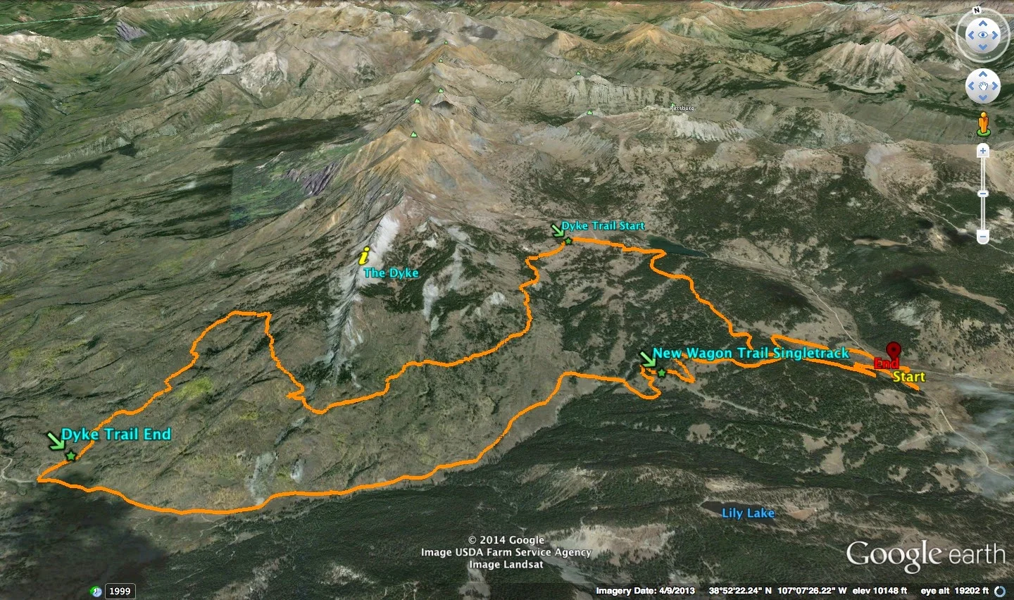
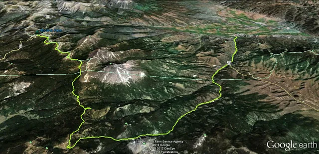
2 Uber Classics - Crested Butte Mtn Biking


The Dyke Trail  Loop (description from Mtn Bike Project)

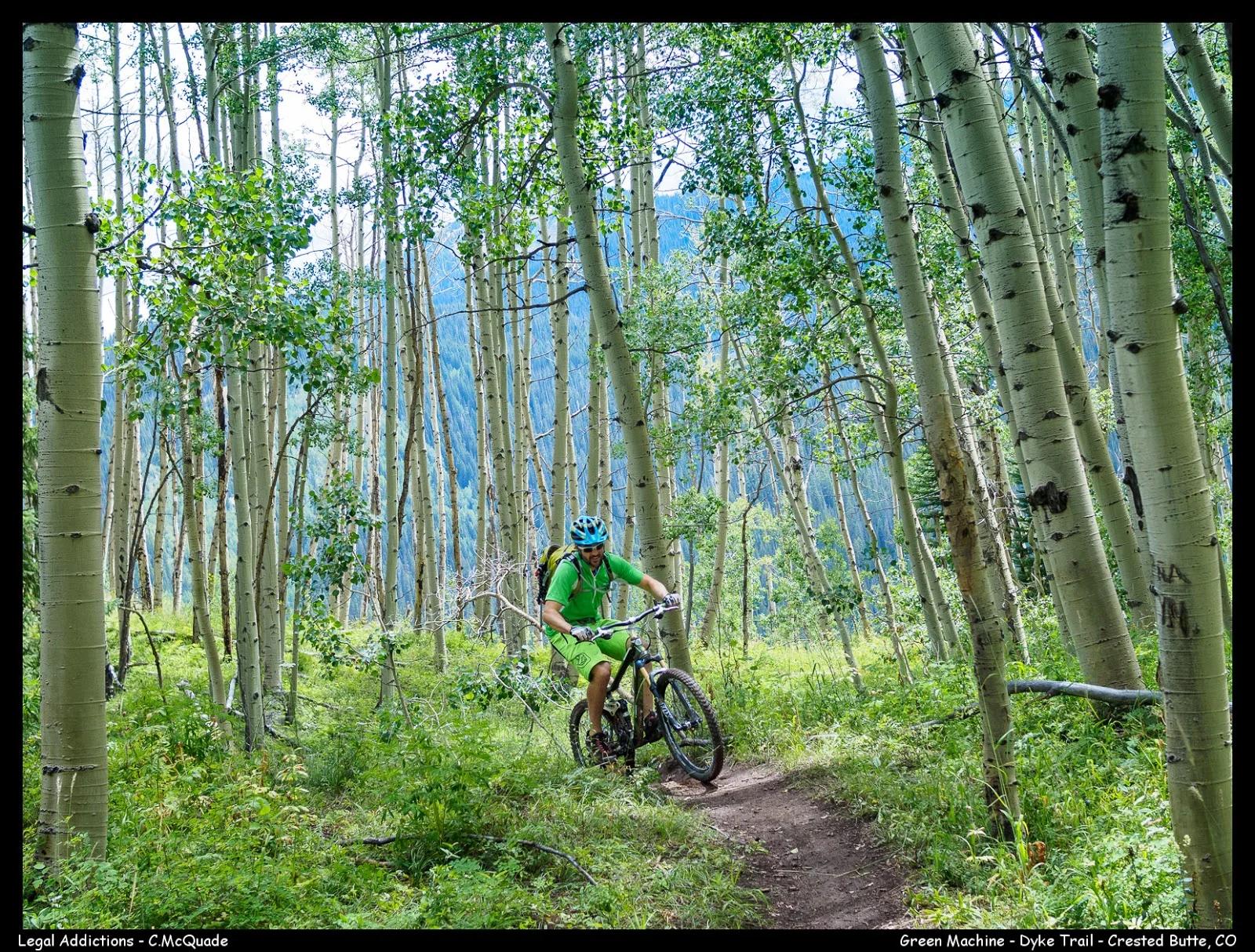
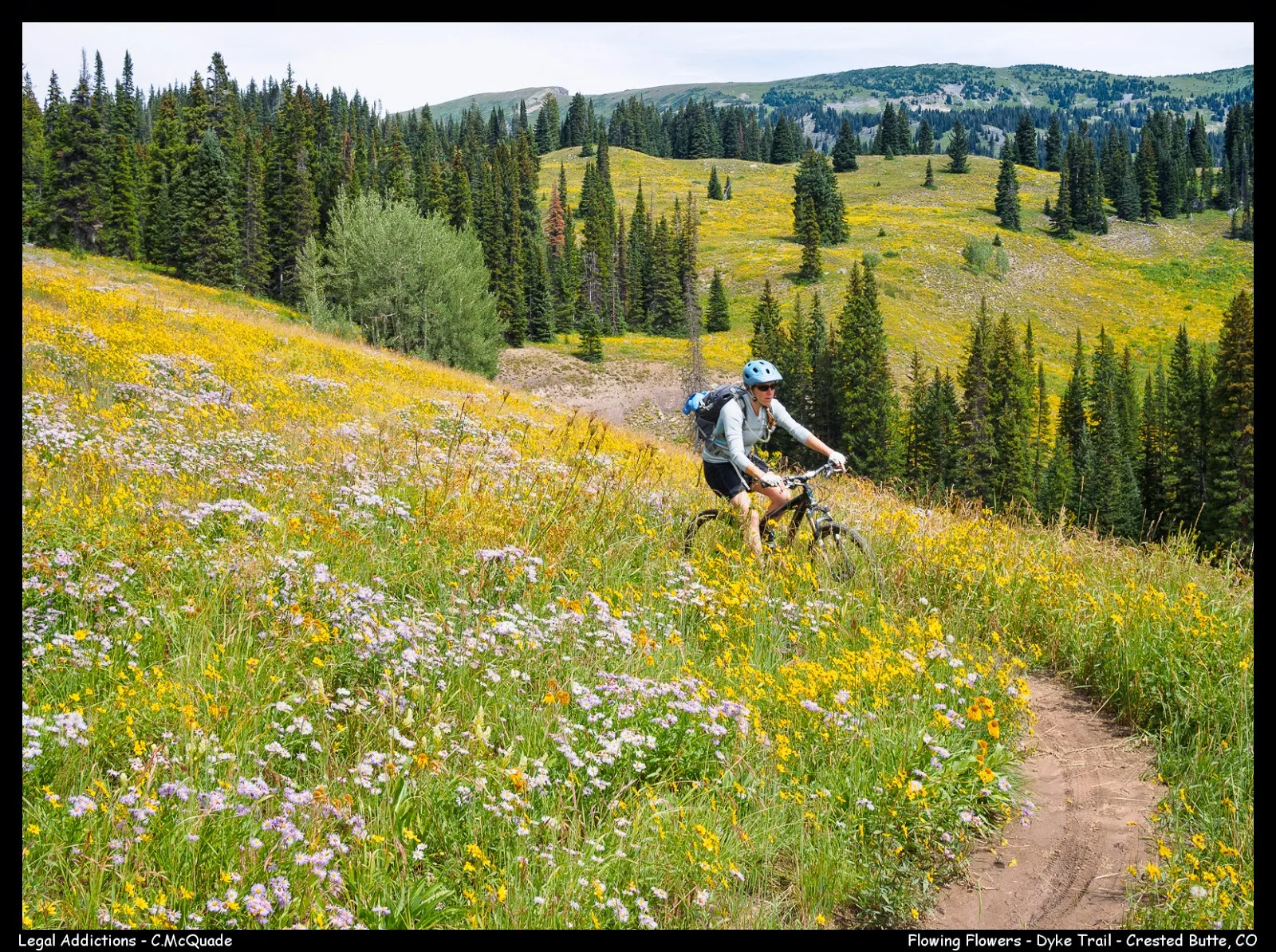
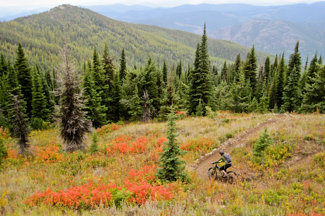
The Dyke Trail should be high on everybody's list of rides to do when visiting Crested Butte.  This trail throws just about everything at you from smooth flowy singletrack, loose technical descents, a leg and lung burning climb in the middle, several small water crossings and fantastic views of the Ruby Range and the Anthracite mountains.  Use the New Wagon Trail singletrack to cut off several miles on asphalt. 
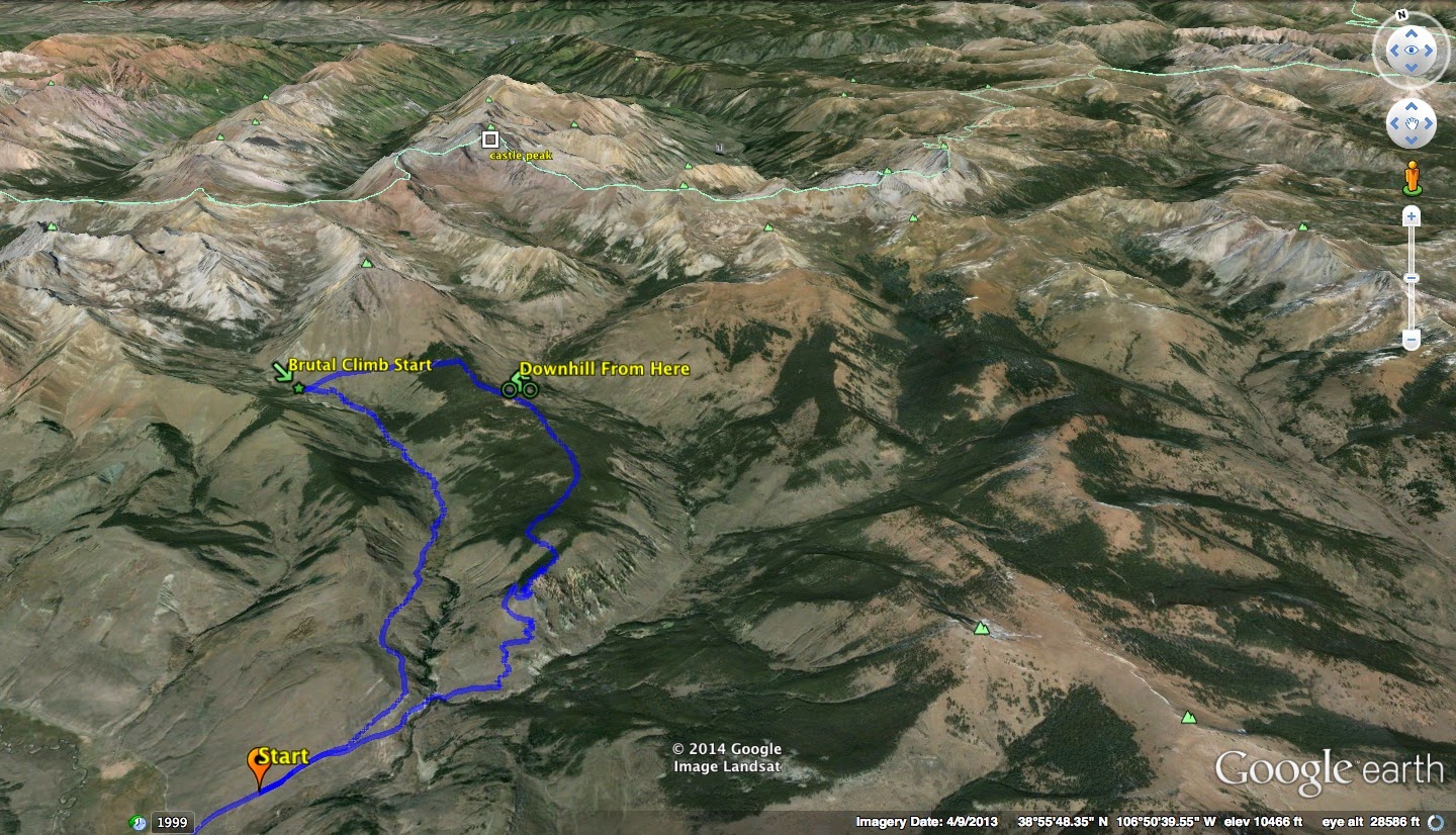
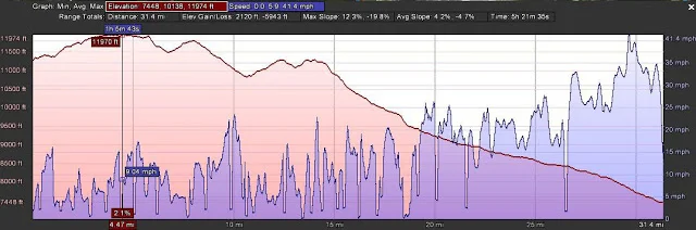
Teocalli Ridge Loop (description from Mtn Bike Project)

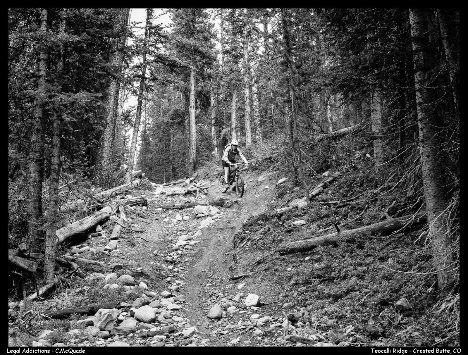
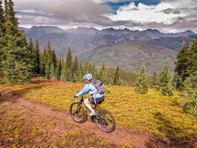
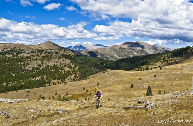
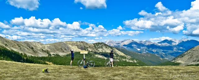
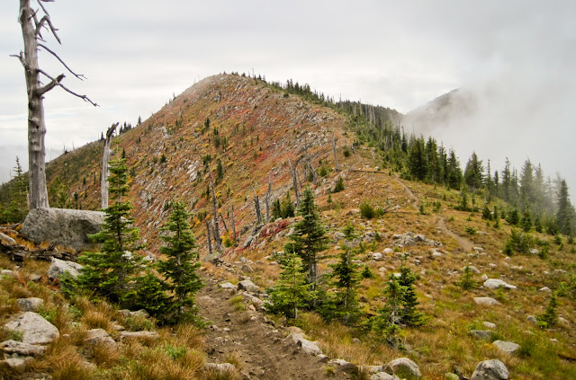
Teocalli Ridge is another classic ride in the Brush Creek area.  Along the way, take in some incredible views up-valley and remind yourself why you enjoy this sport so much.  When you get near the top of the ridge you'll come to a nice view point and stopping area, with great views of Teocalli Mountain, Castle Peak, Pearl Pass, and the Middle Brush Creek drainage on your left. This is a good place for lunch. Drop you seat and get ready for some of the best downhill in the area!


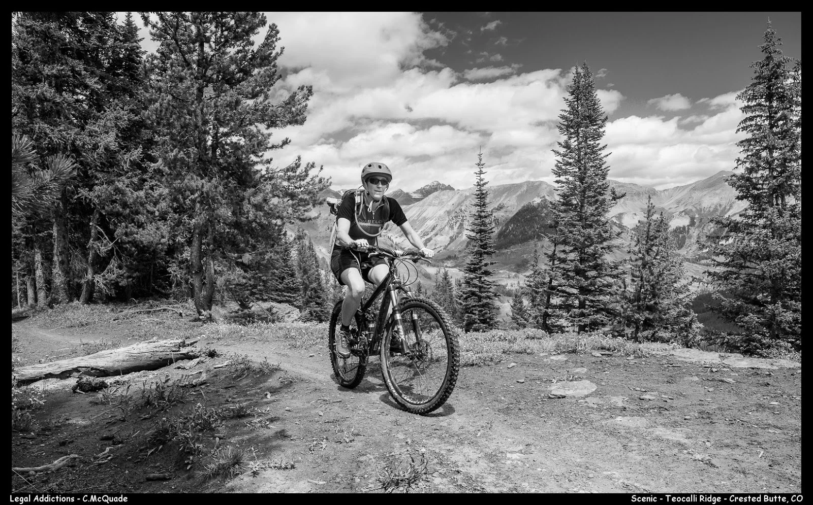
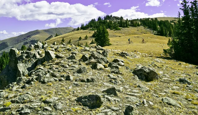
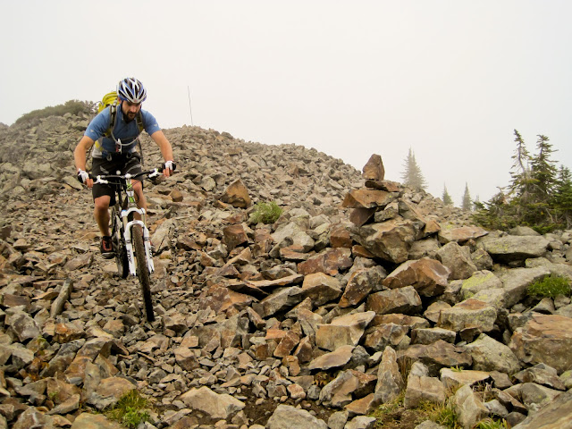
Nearing the end of the brutal climb up Teocalli Ridge before a 2000' screaming downhill descent.  To this point my favorite downhill in the CB area! Especially since the new descent was finished by the Crested Butte Mountain Bike Association --- amazing job!

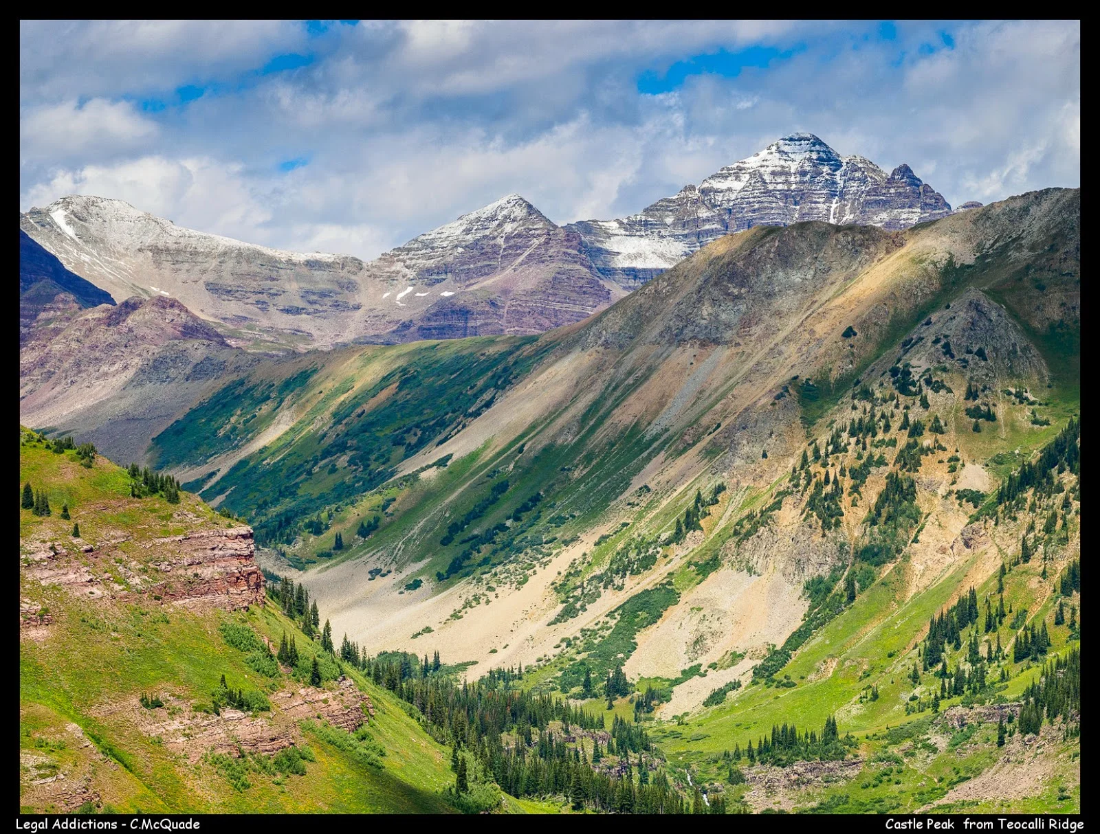
 The stunning view of Castle Pk (14er), with a fresh 6" from the night before.  As seen from Teocalli Ridge

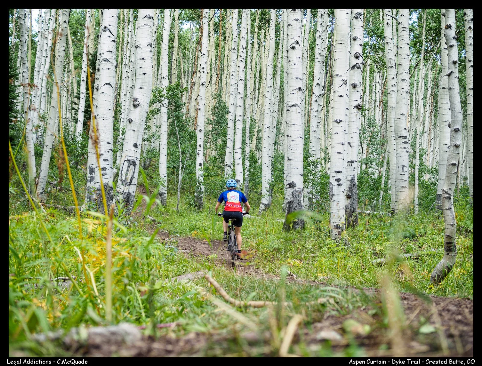
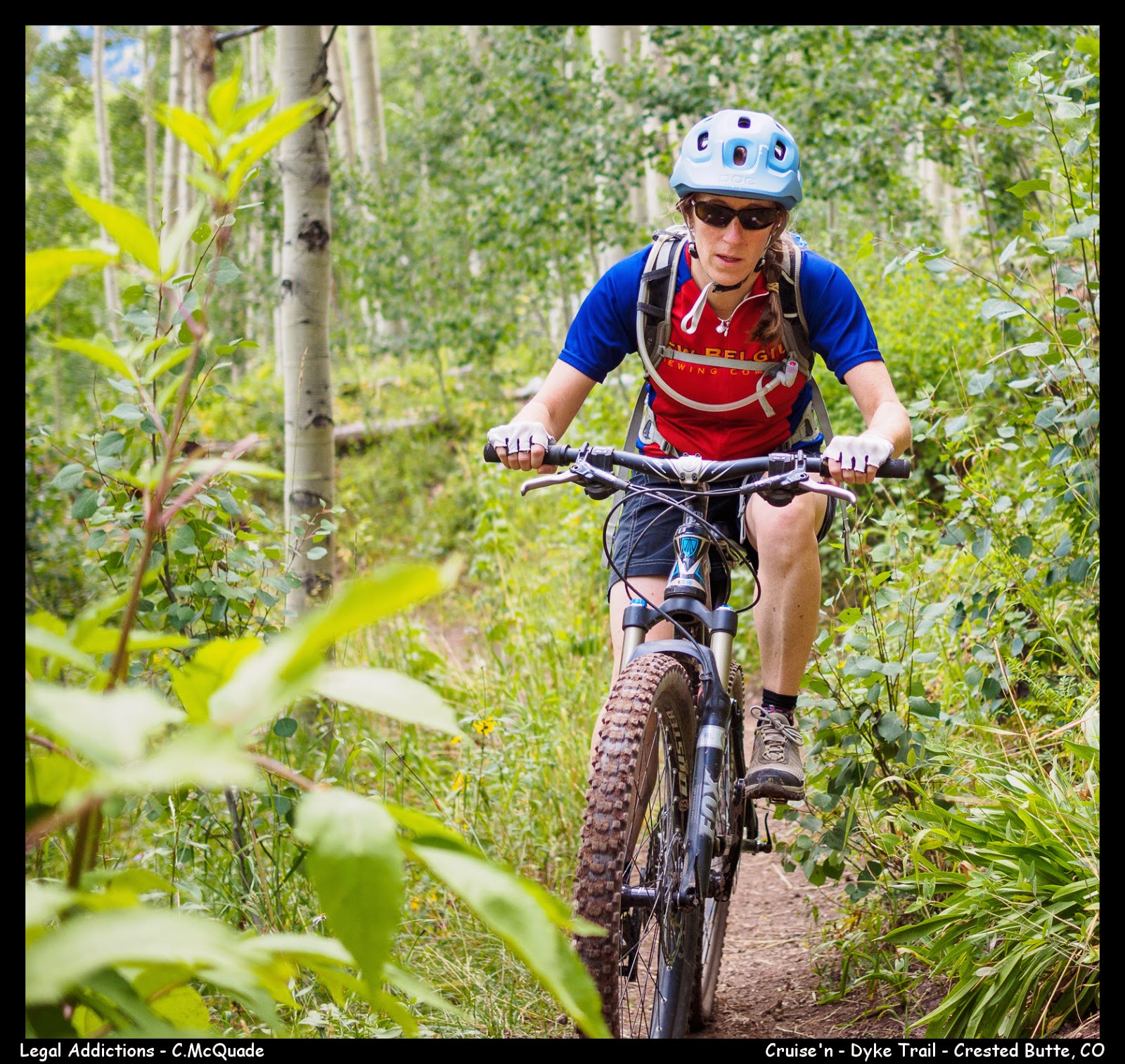
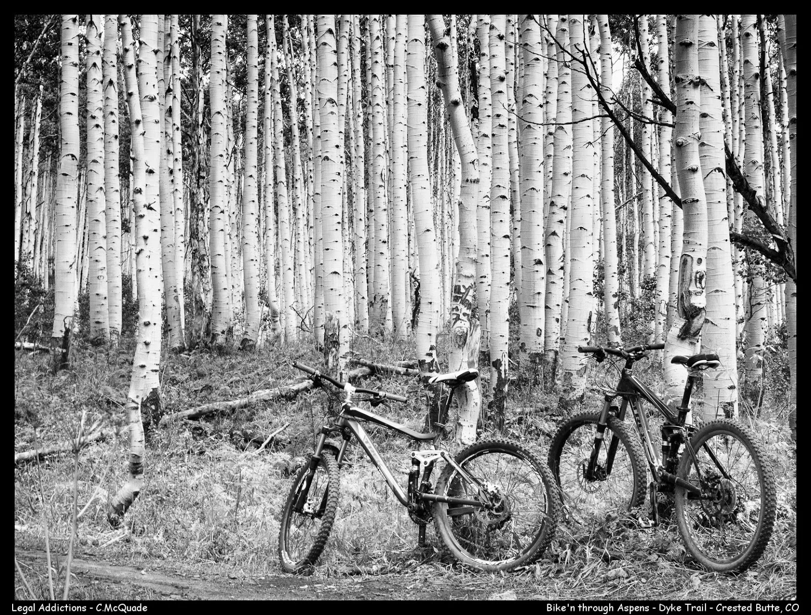
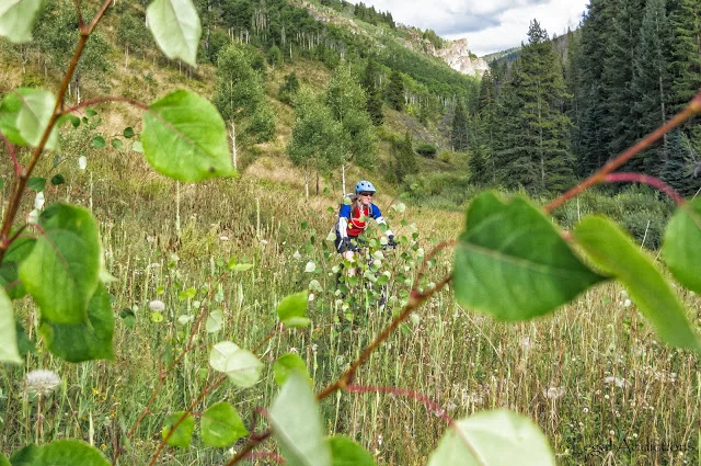
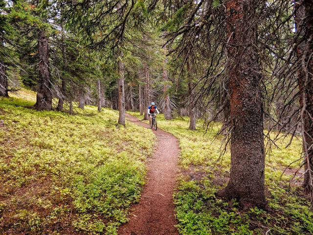
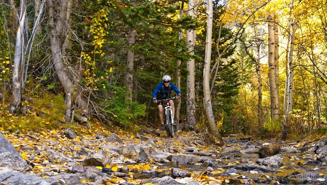
K being engulfed by the massive aspen stand surrounding Kebler Pass on the Dyke Trail.  

The Dyke Trail takes you through one of the largest aspen stands in the US. Confirmed as a clonal colony (single root system)...therefore one of the largest single organisms on the planet.

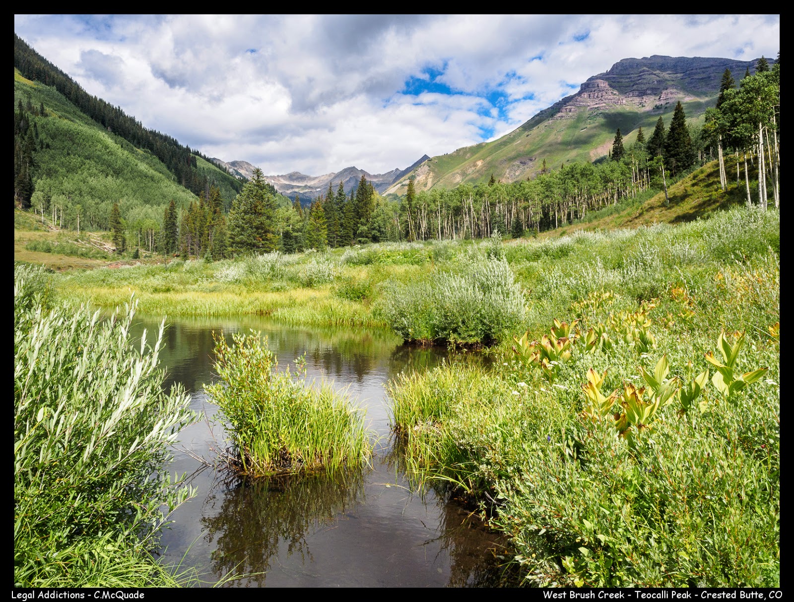
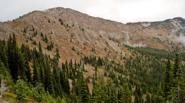
Part of the approach climb up brush creek.  Teocalli is the peak seen right side of photo.  The trail climbs underneath the rock bands to the lookers right


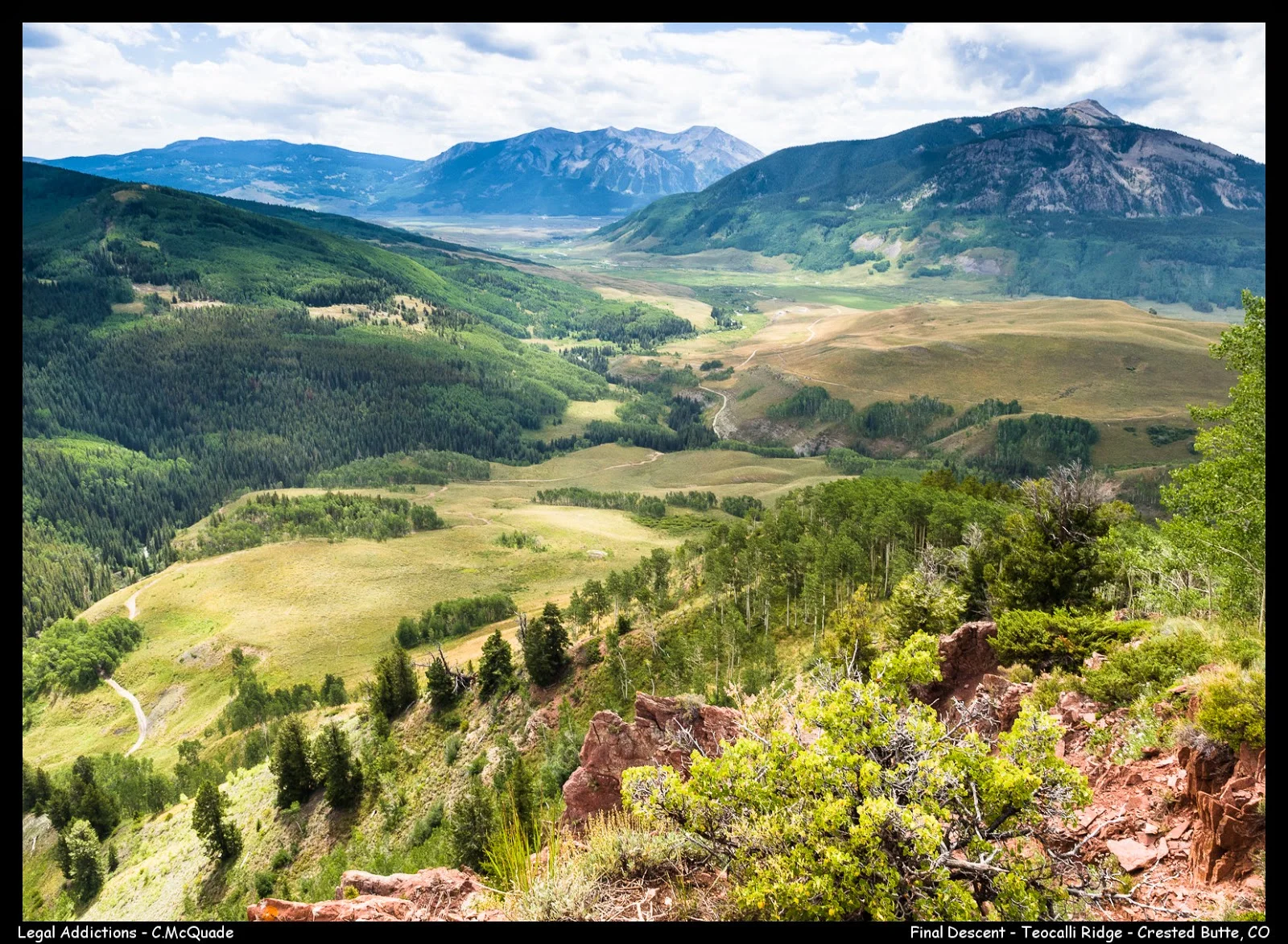
View of the final descent off Teocalli Ridge

So dense

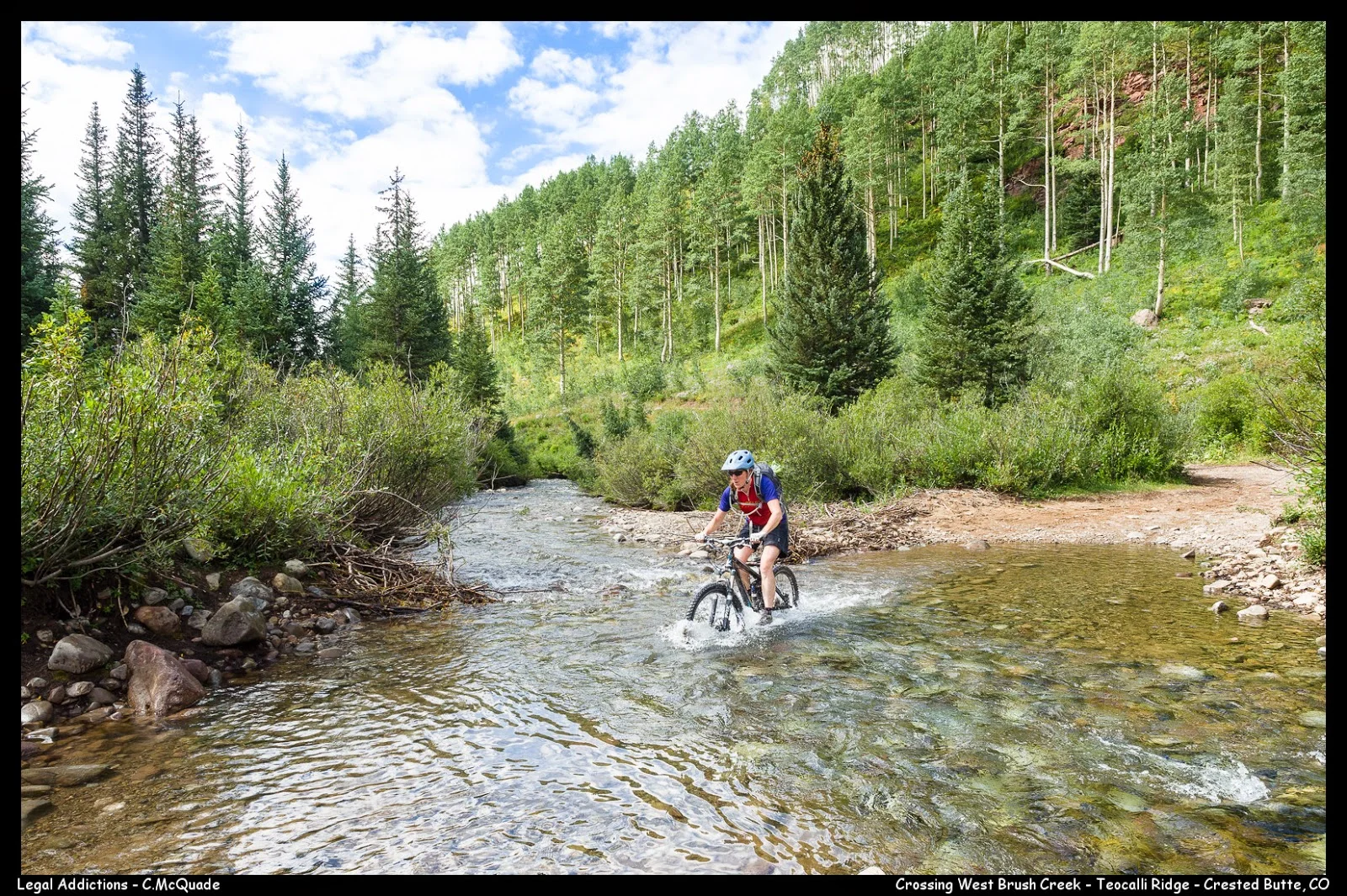
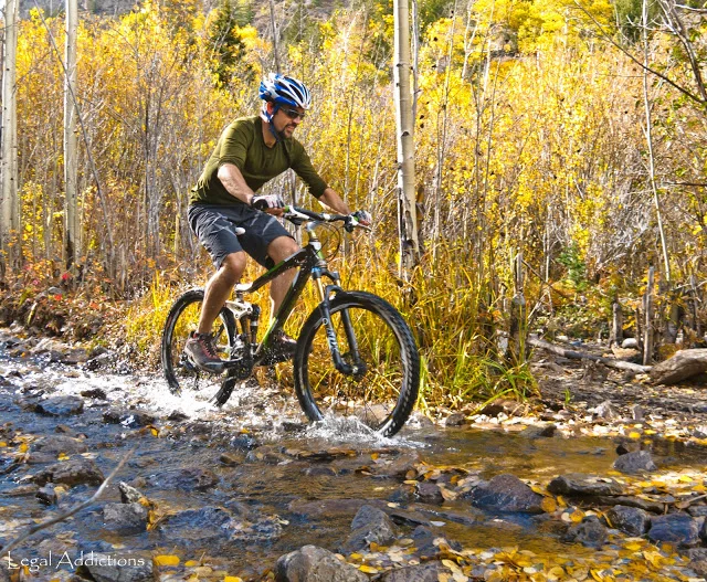
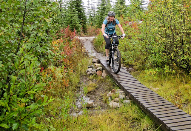
One of Teocalli's  two mandatory creek crossings

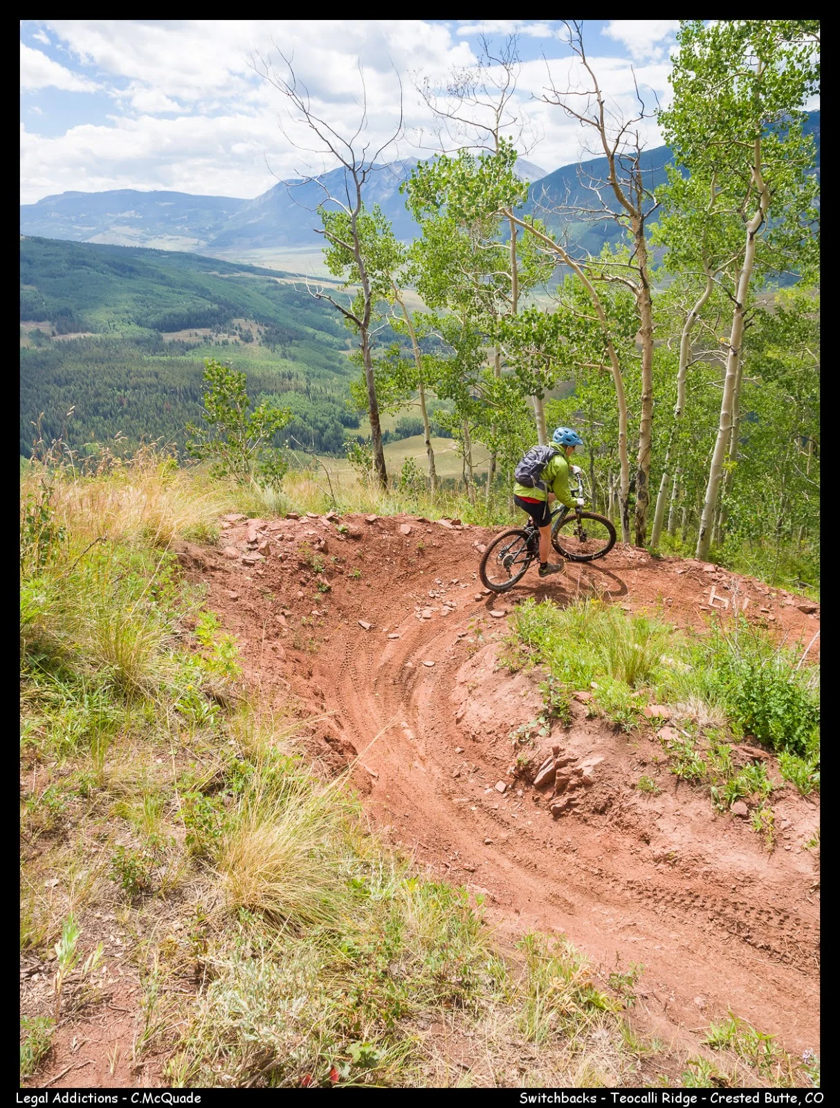
One of 14 new switchbacks established by the CBMBA - notice the cinder blocks they lugged up to help with solidifying the corners


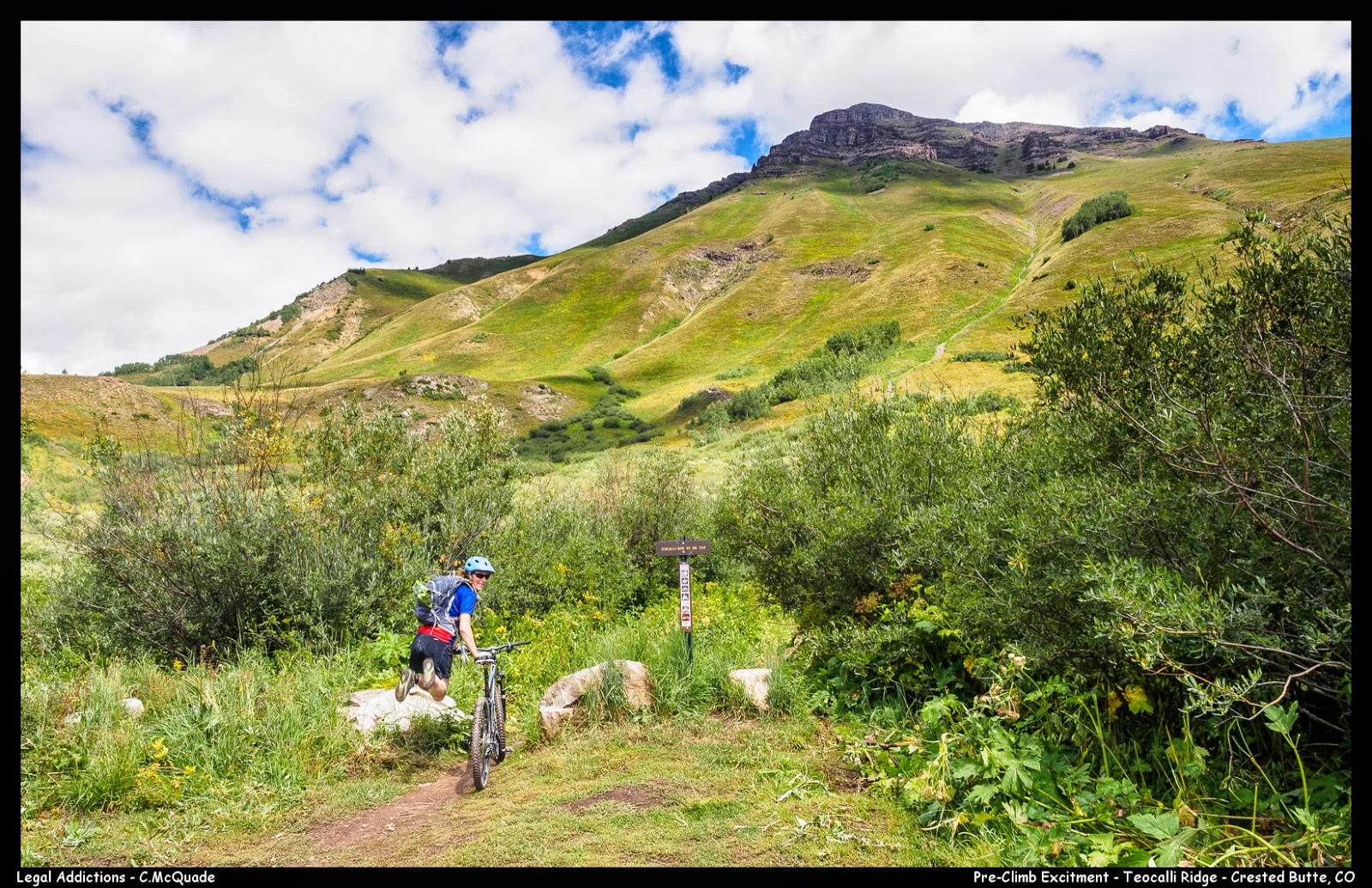
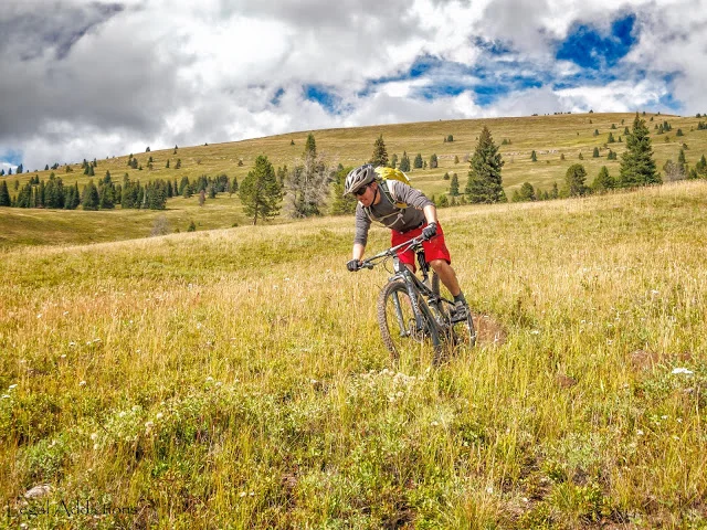
The excitement ended shortly after, as the most challenging part of the climb was just ahead.

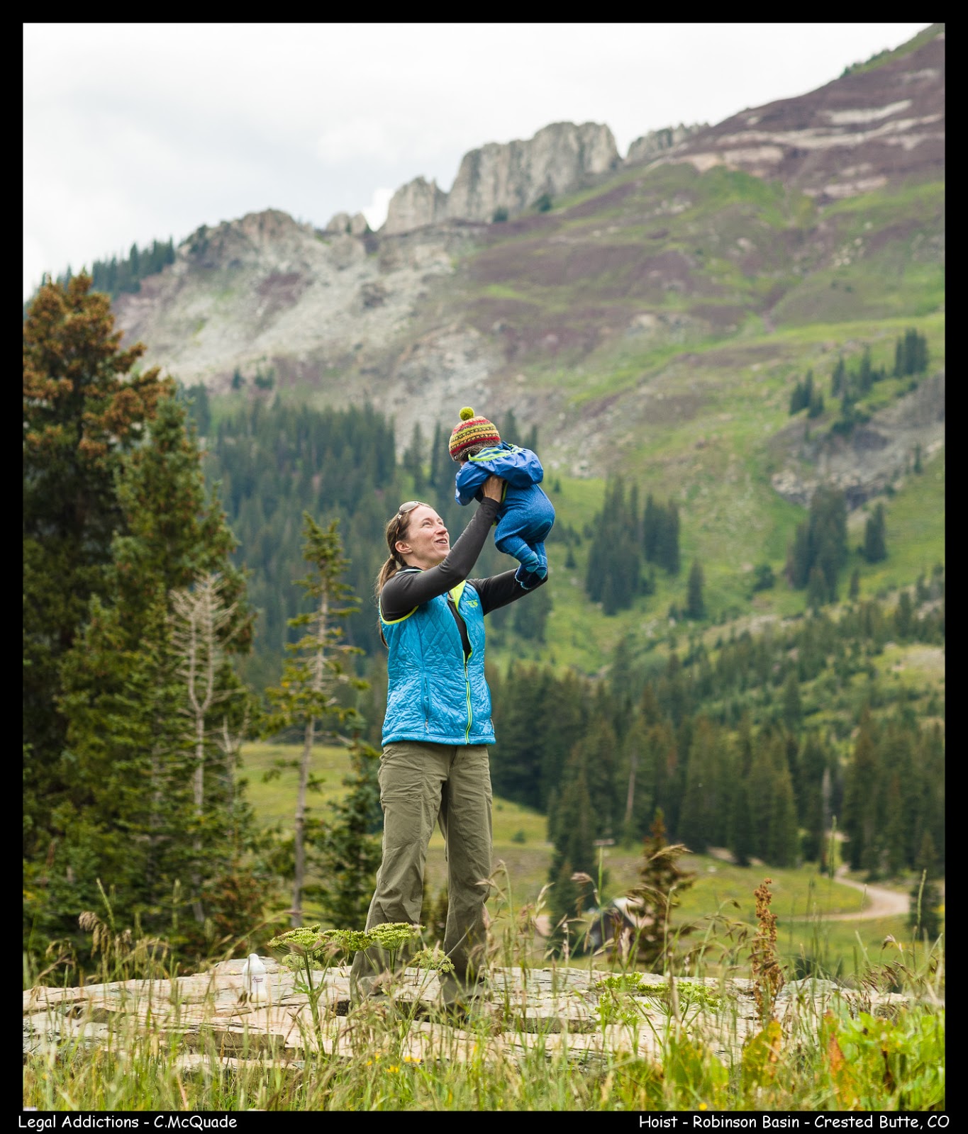
What a perfect time in CB...thanks Grammy D for hanging with Liam and making the biking possible:)

Slickrock'n, Afterdark Arches, & the Enchilada À la carte - Moutain Biking, Moab, Utah

Qualifier: Slickrock

Qualifier: Slickrock

Yup, Im making it official!  If you mountain bike, then do yourself a favor and make a trip to Moab, UT.  Riding slickrock is crazy cool and super unique.  If you decide cranking up sticky rock just isn't for you then go check out the 100's of other great ride in the area.  This was Kristin's and my first trip to Moab.  Awesome! and will be going back.  The Massey's showed us the ropes and took us on several of the area's classics!  All repeaters for sure: Klondike Bluff Area Trails, Slickrock and "The Whole Enchilada"  as called by the locals.

The Whole Enchilada:  Often regarded as the ultimate Moab ride.  A link up involving Burro Pass, Hazard, Kokopelli, Porcupine Singletrack, and Porcupine Rim covering approx 30 miles starting from the La Sal Mountains, with 7000 vertical feet of downhill ended at the Colorado River.

Our version this trip Enchilada À la carte: Thanks to roughly 4" of snowfall on Thursday night up near Burro Pass in the La Sal mountains.  We opted to start the ride at the Kokopelli / Hazard County trail junction (~8500').  Still an amazing ride and hey we skipped out on 2000' climb:)  all downhill on the À la carte version.  And we still got to experience some snow during the ride:)

Mighty Colorado River Carves Below SlickRock

Slickrock Training Brigade - Anne, Thomas and Kristin on Baby Steps Loop trail

The White Dash and Rubber Marks Replace the Trail Cairn - Me on Slickrock trail

Slickrock Luge - Thomas on Slickrock trail

Refuel on the Porcupine Rim Overlooking Castle Valley - Kristin and Anne Porcupine Rim trail

The Klondike Bluffs at their Grandest - This overlook is only reached by a bonus hiking only trail off the Klondike Bluff 4x4 trail

The Endless Slickrock Romp - Kristin on Slickrock trail

Sunset viewing from high up in Window Arch - Anne South Window Arch

Mario Brothers take on Slickrock - Me (Luigi) and Thomas (Mario)

Slickrock Roller-coaster - Kristin and Anne

Tight Squeeze - Kristin on LPS trail

Mario's Personal Cheerleaders - Kristin, Thomas, Anne

The switchback method - Anne demonstrates with a successful burst up the steeps

The MnM Gang wrecks havoc on Sand Arch - a few days later the government shuts down and all National Parks close...hmmm curious - Sand Arch way past sunset, Arches National Park - Kristin, Thomas, Anne, and Me behind the camera

Playing with Ghost Towns, Campfires and Vail's Two Elks

After spending several days trying to stay afloat during record breaking rainfall along Colorado's front range, we packed up and headed west towards Vail hoping for clear skies and a good romp on the VAIL classic -Two Elks

We chose to ride it from the rec parking at Vail Pass to Bowman's Shortcut to Two Elks. Totaling roughly 19 miles.

For full description of the this glorious ride explore the interactive map and links to MTB Project below


Team M&M take on Two Elks

Doing some Campfire Magic to Ward the Rain Away Thomas

Riding Among Aspens - Kristin

Giving the Rain the Middle Finger - Thomas

This Rain isTurning CO into the PNW - Kristin

Town Watering Hole - Red Cliff, CO

Red Cliff is a former mining camp situated in the canyon of the upper Eagle River just off U.S. Highway 24 north of Tennessee Pass The population was 289 at the 2000 census. The town site is concealed below the highway (which passes over the Red Cliff Truss Bridge).  It was founded in 1879 during the Colorado Silver Boom by miners from Leadville who came over Tennessee Pass scouting for better prospects.

Passing in front of the mighty Gore Range - Kristin

Red Cliff Truss Bridge

Weaving Single track through Outer Mongolia Bowl of Vail Ski Resort - Thomas

Red Cliff Truss Bridge

The Wizard Working His Firebow - Thomas

Abandoned Mining Town - Gilman, CO

Gilman, founded in 1886 during the Colorado Silver Boom, the town later became a center of lead and zinc mining in Colorado, centered around the now-flooded Eagle Mine

It was abandoned in 1984 by order of the Environmental Protection Agency because of toxic pollutants.  It is currently a ghost town on private property and is strictly off limits to the public. On February 27, 2008 the Minturn Town Council unanimously approved annexation and development plans for 4,300 acres of Ginn Resorts’ 1,700-unit Battle Mountain residential ski and golf resort; Ginn's Battle Mountain development includes much of the old Gilman townsite.

The townsite is a victim of vandalism, and the town's main street is heavily tagged. There are only a few intact windows left in town, as twenty years of vandalism have left almost every glass object in the town destroyed.

However, many parts of the town are almost as they were when the mine shut down. The main shaft elevators still sit ready for ore cars, permanently locked at the top level. Several cars and trucks still sit in their garages, left behind by their owners.

 Gilman Ghost Playground Girls - Kristin and Anne

:)

An Alaskan Hat-trick - PackRaft'n , Mountain Bike'n , Boretide Surf'n

Alas, my first summertime AK visit!  It was well worth the wait and kept us busy with endless breathtaking adventure. That's breathtaking both visually and physically...as we played with friends in the extraordinarily beautiful Alaskan backcountry  via 3 modes of FUN; the packraft, the mountain bike and the stand up paddle board.         


2300 Sunset - Looking across the mud flats of the Knik Arm


Packraft Transition - Kristin

  • K inflating her packraft with the ultralite airbag (glorified garbage bag) after a 4 mile approach- hike with paddles, packrafts, helmets and dry suits on our backs 
  • The ingenious idea was developed and fine tuned in both AK and CO, we are finding them to be, yet another awesome toy. The Alpacka Packraft , made in Colorado 

Interactive Map - Click on Icons and zoom in and out for more detail


View Glacier Creek PackRaft in a larger map


Kincaid Singletrack Park - Me On Fat-Tires!

  • Thanks Chip and Gina for lending the fatty's


My Denali Llama

  • During a walk and scout section of lower Glacier Creek (looking for the dangerous rumored sweepers)


Chameleon on Wheels - Anson

  • Several of us got together for a ride to Lost Lake, north of Seward, AK.  What breathtaking singletrack in a perfect setting!


Glacier Creek 2nd Round - Kristin
  • Kristin and I head back for a second day on Glacier Creek, before heading to the Turnagain Arm to surf the Bore tide with Anson.  Here K attaches her backpack and dry sac to the bow of the boat.


77 degrees in AK - Kristin after surfing the bore-tide

  • Quite the experience: Surfing the Turnagain Arm Bore tide: Thanks to Anson, Landon and Monica for showing us the ropes:)  
  • The bore tide is a huge wave or series of waves that advance down Turnagain Arm in a wall of water up to 10-feet high.  Its known as one of the biggest in the world.  One unique aspect of the Turnagain bore tide is that all other bore waves run up low-lying rivers in more southerly latitudes. The Turnagain wave is the only one that occurs in the far north and the only one bordered by mountains.  It’s also amazingly accessible: you can see it by road along its entire 40- to 50-mile length. And it’s a wildlife-spotting opportunity: harbor seals often ride the tide into Turnagain Arm. Beluga whales may come in a half hour or so later once the water gets deeper.


Breathtaking Vistas - Lost Lake Mountain Bike Ride


Spencer Glacier Packrafting Enduro DayDarcie, Stephanie, Anson, Hope

  • Train to Spencer Glacier Whistle Stop, paddled up to the Spencer Glacier, then floated for 3.5 hours down the Placer river back to the Turnagain Arm (see map below for details)

Interactive Map - Click on Icons and zoom in and out for more detail


Glacier Water Air Guitar - Anson  on his Standup Paddle Board (SUP)

  • About to take a bone chilling dunk, in the far background is Spencer Glacier.  From this point took about 1 hour to paddle upto.  And yes he floated the Placer river on his SUP, and yes packrafts are more stable in the rapids:)


All Smiles + a Bark - Anson, Darcie, Kina, Kristin

  • The crew takes a break during the fast downhill after enjoying the scenic climb upto Lost Lake.


Nearing the Toe of Spencer Glacier - Kristin in her Alpaca


Fireweed

  • Now only if our backyard grew weeds like this.  This stuff is everywhere.  And once the blooming stops the countdown to 6 more weeks of summer begins


Glacier Creek Crusaders - Darcie, Stephanie, Kristin, Anson, Me

  • About an hour into the run we pull off and exits the boats to check for sweepers and strainers near the Girdwood airport.  By this point the rapids start to mellow, leaving only sweepers and strainers and low water levels as the only hazards.


Loosing Lost Lake - Kristin


New Mexican Irony - My personalized paddle by Anson


Packrafts in Tow - Our approach hike into Glacier Creek

  • Yet again ol AK never disappoints!  What what a great group of friends we have, so lucky, everyone is always up for an adventure!  And Anson thanks again for the use of your toys!  

Ride, Hot Tomato, Siesta, Ride, Beer, Repeat - Fruita, CO

We had to go get it before the western slope got to HOT!  Fruita that is, and we got it!  What a rad place, great biking, great food and great beers!  For three days our cycle was as follows:
  1. Bike
  2. Hot Tomato Cafe 
  3. Siesta
  4. Bike
  5. Copper Club Brewery
  6. Return to 1. and repeat
  

 FRUITA!!!! - Backwards Endo over the Sandstone Crevasse - Mack Ridge Trail


Sandstone Mesa-Top Riding - Horsethief Bench Loop below

Day 1 of our Fruita visit we put in a great tour of the Kokopelli trail system (west of Fruita) via a brilliant connection of some of the areas best singletrack.  In summary we started on Mary's Loop connected into Horsethief Bench Loop, back to Mary's then connecting into Steve's Loop, repeating a short section of Mary's Loop until joing into Wrangler's back down to the car.  An excellent description of the loop, including gps tracks and maps can be found by clicking on the MTB Project link.

Also check out Over The Edge Sports a great bike shop with a very friendly staff, whom are all knowledgeable and not afraid to share their ride beta for the area. 


Balancing along Mack Ridge with the Colorado River Twisting Below


A Painted Desert


BookCliffs as seen from the - Frontside Trail

For practically no climbing and amazingly flowy, fast and super playful downhill head to 18 Road Trail System, north of Fruita.  A few pearls for the area:  leave your food and larger quantities of water in your vehicle at the main parking lot, as the trails for the most part all end up back at the parking lot!  refuel and go for the next round.   


Getting surprised by a steep on the screaming fast descent - Zippity Do Da Trail


The Fast and Playful Horsethief Bench Loop


Steve's Loop viewed from Mack Ridge


 K cornering under the Horsethief Bench


Slot Canyon Riding - Steve's Loop

What a glorious section of Steve's Loop, first you ride along the slot canyon's edge before climbing up above for great views of the trail you just left behind.

Drew Banking near the Edge of Mack Ridge


Don't Exit This Corner to Fast :)


Desert in Bloom


Trails Creepily close to Slot Canyons


 Collard Lizard


Zippity's Nicely Exposed Ridge Rolling Trails


Yuccas n Bikes


Tireless views of Kokopelli from along Mack Ridge Trail - Lion's Loop and Steve's Loop seen below 


See You in the Fall Fruita :)


Crank Yankin, Eddyline Feastin, Hot Springin - Monarch Crest Trail

Qualifier: Monarch Crest - IMBA EPIC

Qualifier: Monarch Crest - IMBA EPIC

We've had the Monarch Crest Trail on our todo list for awhile now...  As should everyone its that rad!  A few suggestions for after the MC trail and your epic ride will end perfectly!

  1. Eddyline Brewery in Buena Vista, CO
  2. Cottonwood Hot Springs in Buena Vista, CO

Date: Sept 29, 2012

Riders: Drew, Graham, Kristin and Me

Mileage: 32 miles

Elevation Gain: 2800' with 6500' of Downhill Bliss

Average Pace: 10 min/mile

Total time includes breaks: 5 hours 15 mins

Trail description: Its the Monarch Crest Trail - no description needed its perfect!  Get Out and Ride It!  

PURE BLISS - 32 miles of one of our nations top MTN Bike Rides

Elevation with corresponding speed profile - topped her out at 42 mph on hw 285 back to Poncha Springs :)

Like always click on pics to see better resolution

Photo caption ContributionsIf your feeling clever therefore would like to re-caption any of the photos,  leave a comment on the post.  I will then re-caption the photo followed by your name.

K - Crank Yanking at 12800'

The only steady climb on the crest, below Chipeta Mtn and Mt. Ouray wth Pahlone Peak in the background

Drew - Clown Wheelin on that there 29er

Brothers looking for Oxygen at 12000'

Who Drowned my Trail

CD trail meets COT

Graham - Gettin his creek time

A Summit County 5 Star Loop - Keystone Gulch to Aqueduct Trail

Following a day of recovery from our combo housewarming / birthday party K, Drew and I saddled up and set course for Keystone.  Our goal a widely suggested loop ride: Keystone Gulch to Aqueduct Trail.  Receiving 5 / 5 stars from Dan Hickstein's new guidebook:  The Mountain Biker's Guide to Colorado and ecstatic reviews from Tom and Anne who rode it the previous day.  We were primed for some rad riding!


Date: Sept 3, 2012
Riders: Drew, Kristin and Me
Mileage: 18.3 miles
Elevation Gain: 2958'
Average Pace: 15 min/mile
Total time includes breaks: 4 hours
Trail description: A quick climb via Keystone Gulch road passing several of the Keystone ski lifts, then escapes the road passing an iron gate.  After another climb on singletrack you join up with the COT (final portion of Segment #6 - Kenosha Pass to Gold Hill).  As usual the COT didn't disappoint,  I found the next several miles to be the best of the loop (all downhill).  From here you bid farewell to the COT and follow yet another piece of splendid singletrack north along Soda Creek eventually joining into Aqueduct trail and returning you to Keystone Gulch trailhead.      


A couple of important unmarked trail junctions along the way

Elevation with corresponding speed profile

Like always click on pics to see better resolution

Photo caption ContributionsIf your feeling clever therefore would like to re-caption any of the photos,  leave a comment on the post.  I will then re-caption the photo followed by your name.

Trees Eating Bikes


Corner K


Beetles Eating Bark


Drew (aka CT 10k)


Only Bikes


CT 10k Gets Wet

Great Rides & Great Peeps - CB Mountain Biking

Post Trail #401 Filth
Generally known as the birthplace of mountain biking......

Crested Butte, Colorado, does not disappoint!  Well until its time to load up the bikes and pull out of town.  CB has it all: techy, cruisers, steep, amazing high alpine scenery,......I could go on forever or just go get a taste of it yourself.  If the biking isn't enough of an allure, maybe downtown CB will be.  What a rad place to end your ride.  A few of our favorites include: The Brick Oven Pizzeria (great tap selection), Pitas in Paradise, and Dogwood Cocktail Cabin (an absolute must).


Day 1Upper Upper to Strand Hill to The Brick Oven Pizzeria


Click to enlarge
Date: June 22, 2012
Riders: Anne, Tom, Kristin, and Me
Mileage: 17 miles
Elevation Gain: 2200' (click for elevation profile)  
Average Pace: 14 min/mile
Total time includes breaks: 4 hours
Trail description: Upper is a mix of rocky and flowy, providing good views of the town of CB as it traverses underneath Mt Crested Butte.  A short spin on CO road 738 gets you to Strand Hill then an enjoyable fast flowy downhill among endless aspens. 


Day 2Bear Creek to Doctor's Park to hot tub and pizza to go


Click to enlarge
Date: June 23, 2012
Riders: Penny, Aaron, Anne, Tom, Kristin and Me
Mileage: 21 miles
Elevation Gain: 3200' (click for elevation profile)
Average Pace: 14 min/mile
Total time includes breaks: 5 hours
Trail description: A vast network of trails defines the Taylor Park arena, expect slightly lower elevation, and dryer conditions then the CB area proper.  We shuttled from North Bank Campground to Spring Creek Reservoir - allowing for two great descents down Bear Creek and then Doctor's Park. Due to the extremely dry winter, the Taylor Park area was uncharacteristically dry...moon-dust like conditions.  Aside from the dry conditions the two down hills were awesome, I cant wait to return under better more packed conditions.    


Day 3Trail #401 to Dogwood Cocktail Cabin to Pitas in Paradise


Click to enlarge
Date: June 24, 2012
Riders: Anne, Tom, Kristin, and Me
Mileage: 10 miles
Elevation Gain: 1900'(click for elevation profile)
Average Pace: 15 min/mile
Total time includes breaks: 2.5 hours
Trail description: The CB mega classic, cant say enough about this trail.  High alpine meadows with unbeatable views! We choose to leave a vehicle at Copper Creek trailhead near Gothic and shuttle up to the "Plug" just before Emerald Lake.  


The Pics:

Alpine Splendor - Trail #401 - day 3

Creek Skimming - Aaron - day 2

Famed Downhill - Doctor's Park - day 2

Anyone seen my Snorkel? - Anne - day 2
The Hand-off - Kristin, Anne - day 3

Girls Peaked Out - Penny, Anne, Kristin - day 2

AT&T full signal - start of Trail #401 - day 3

Skunk Cabbage Cruiser - Tom -day 3

High Alpine Meadow Beauty - Trail #401 - day 3

Skunk Cabbage Speedster - Anne - day3

Splashdown - Kristin - day 2
The Beetnik's  - Aaron, Tom, Anne

The Poco Loco's - Anne, Kristin, Chuck, Penny


Trail Map:  CB riders don't leave home without this one.  Once in CB stop by Big Al's Bicycle Heaven to pick up a copy, 13.00.  


Season Lasts - Shelf Road, Buffalo Creek


We kicked off the last week of November with some catch phrase and sour cream apple pie at the Lansing's for what was an amazing Thanksgiving dinner.  A few days later we crushed some stone down at Shelf Road for a few days in what turned out to be the falls best weather for climbing, low 60's and nothing but sun.  We left shelf wondering if it was the final climbing trip of the year, especially with the snow starting to accumulate.  The final day of our off week we went up to Buffalo Creek for some amazing singletrack.  I love Buffalo Creek!

Buffalo Creek:

Remnants of High Meadows Fire of 2000 - Does make for some awesome singletrack


Granite Moab - Buffalo Creek area offers a lot of rock features and sections of trail strictly on rock


Survivors


Camo - Where's Kristin?


Shelf Road:

Muscle Beach 5.11a/b - A Vaino Kodas, Bob D'Antonio masterpiece 2001


Noteworthy Sends:

Morpheus 5.11b

  • OS

Muscle Beach 5.11a/b

  • OS

Backyard Biking - A Little Taster

Its been quiet sometime since our last post.  I guess that means we have been having to much fun to sit in front of computers and create blog posts:)  Its amazing how fast the summer months have flown by since our relocation to G-Town.  Most of the summer has been spent rock gripping, its just so hard to do anything else with all the epic rock around here.  We've managed many mountain bike rides within the area, however not enough high alpine rides....and there has already been snow topping higher elevation peaks!  I guess the alpine rides will be on the docket for next season.

GPS Tracks:
  • Dedisse Trail, near Evergreen, Colorado
  • Bergen Peak Trail, near Evergreen, Colorado
  • Centennial Cone Trail, Clear Creek Canyon, Colorado
  • Kenosha Pass Trail, near Como, Colorado (18 of 30 miles completed)
    • unable to complete Kenosha pass trail, typically ridden as a 30+ mile ride over Georgia pass finishing with a mind blowing brake slamming descent into the town of Breckenridge.  If you don't have willing friends to pick your now sore behind up in breck and drive you back to your car at Kenosha Pass the ride turn into 60 miles with over 8000' vertical gain. 
    • Kenosha Pass to Georgia Pass to Breck is regarded by many as one of the best portions of the Colorado Trail for mtn bikers. Next time some butt butter and an earlier start.  Oh ya we wont forget the beer to bribe friends to pick us up in Breck and shuttle us back to the truck:)
 
K grinding it out (Dedisse Trail)


Running from the eye, we later got hammered (Centennial Cone Trail)

Ten Mile/Mosquito Range (Kenosha Pass Trail)


The "Epics" Begin - 7 Summits - Rossland, BC

Qualifier: Seven Summits IMBA EPIC

Qualifier: Seven Summits IMBA EPIC

The International Mountain Bicycling Association (IMBA) each year publishes an Epic Rides list.

The 2010 Epic Rides List included Seven Summits, Rossland British Columbia.  A quick perusal of the Epics list last fall resulted in a weekend venture to our neighbors up north.  The Seven Summits Trail of Rossland, British Columbia.  This 35.8km trail, ok ok I know darn kilometers, but I thought I'd stick with the Canadian theme here.  So the 22.25 mile trail tackles rolling singletrack with beautiful mountain vistas, some steep ascents and thrilling descents. The trail follows ridgelines, affording views of the Columbia River Valley and the Southern Selkirk Mountains, and challengesriders with technical sub-alpine terrain.

Trail Logistics:

The Seven Summits trail is designed to be ridden in a North – South direction, and to link with the Dewdney trail. Leave a vehicle at the bottom of the Dewdney trail on Hwy 22, near the US Border in Paterson (12 km South of          Rossland) and arrange a 30km shuttle to Nancy Greene Pass. The trail begins immediately behind the trailhead                  kiosk at the Pass.

K scoping out the trail overview map at the trailhead kiosk

our GPS tracks

just another view

One of the summits in route

Looking back at the trails highpoint

Scree is not the best media for biking